Rare Species and Uncharted Territory Highlight North Carolina’s Headwaters State Forest
Oldtimers say the mountains of western North Carolina eat men. It is a legend easily forgotten on the well-worn trails of DuPont State Recreational Forest or Pisgah National Forest in Brevard.
But plodding through the feral bramble of Headwaters State Forest, Transylvania County’s newest backcountry playground, is a sobering reminder.
“It is not easy getting in and it is not easy getting out,” says Michael Cheek of the North Carolina Forest Service (NCFS). “This is an experience for people who want to be remote.”
Cheek’s warnings echo a passage in the Book of Camping and Woodcraft by Horace Kephart. In the 1906 text, Kephart describes “two powerful mountaineers” who were swallowed by a “godforsaken” laurel thicket near Thunderhead Mountain in Tennessee. “We couldn’t crawl, we swum,” the men recalled. In two days, they only covered four miles.
Navigating Headwaters, a 6,730-acre parcel on the North Carolina-South Carolina border, requires a similar dose of mental fortitude. Generally speaking, this is not a place for the ill-prepared. This is not where tourists squabble over limited parking or line up for the porta-potty. Even on a cloudless Saturday morning in the summer, when golden light pilfers through stands of white pines in that beautifully haunting way, it is unlikely you will pass another human in Headwaters.
“And the Forest Service is fine with that,” says Kieran Roe, executive director of Conserving Carolina, a land trust based in Hendersonville. “The chief goal is conservation, not so much recreation.”
In 2009, Rep. Charles Taylor approached Conserving Carolina about selling his family’s land. Roe’s team instantly recognized what was at stake: safeguarding the parcel from the clutches of developers would mean preserving more than 50 miles of high-quality trout streams, countless waterfalls, rare Appalachian bogs, and the headwaters of the East Fork of the French Broad River. “It was one of the largest remaining contiguous blocks of private land left in western North Carolina,” Roe says.
For a decade, Conserving Carolina worked with The Conservation Fund to raise $20 million for the real estate acquisition while the NCFS drafted a management plan. On September 6, 2018, Headwaters was opened to the public for “low-impact recreation.” That means foot traffic only, no restrooms or visitor centers, spottily marked trails, and, in many cases, gravel roads washboarded by heavy rains.
But what Headwaters lacks in guest accommodations, it makes up for in unadulterated wildness. Its cool, damp coves harbor rare species like the hellbender, green salamander, gorge filmy fern, gnome rock lichen, and brook trout—the only trout species endemic to the area. Since the forest is adjacent to nearly 100,000 acres of conservation lands, it is also a haven for white-tailed deer, black bears, and, as many locals will tell you, mountain lions.
However, natives are tight-lipped when you start asking about summer swimming holes or coveted waterfalls. “I’ve heard talk of upwards of 25 waterfalls in the forest,” Cheek says. “A lot of people like to go looking for them.”
Though even Cheek is hesitant to “give too much away,” he did offer some insider intel on ways hikers can experience Brevard’s best-kept secret. Of course, you should always tread lightly and come prepared. “People do get turned around. We’ve had two lost hikers since we opened,” Cheek says. “If you’re unable to take care of yourself, it will be an unpleasant experience.”

Three Headwaters Hikes
Bursted Rock via the Foothills Trail
- Difficulty: Strenuous
- Length: 9.9 miles
- Elevation Gain: 2,680 feet
Headwaters is home to a short segment of the Foothills Trail, a 77-mile footpath that dances along the North Carolina-South Carolina state line. This particular hike follows the Foothills Trail beginning at Sassafras Mountain, the highest peak in South Carolina, and will require that you park a second car at the Gum Gap access area in Brevard. But the views are worth the extra coordination.
Even before you begin your grueling, 2,680-foot ascent, you are rewarded with dramatic panoramas of Lake Jocassee and the Blue Ridge Escarpment from a tower atop Sassafras Mountain. Then, after clomping up and down what feels like an endless procession of mountains, Bursted Rock will compensate you with one of the best, if only, views of the north side of Table Rock Mountain.
Gravley Falls
- Difficulty: Easy
- Length: 1.2 miles
- Elevation Gain: 130 feet
Transylvania County is pegged as the “Land of the Waterfalls,” and with good reason. Gravley Falls is just one of the 250-some cascades that can be found in the county. Though this particular waterfall is not as stately as what you may find in neighboring DuPont State Recreational Forest, it is far less crowded.
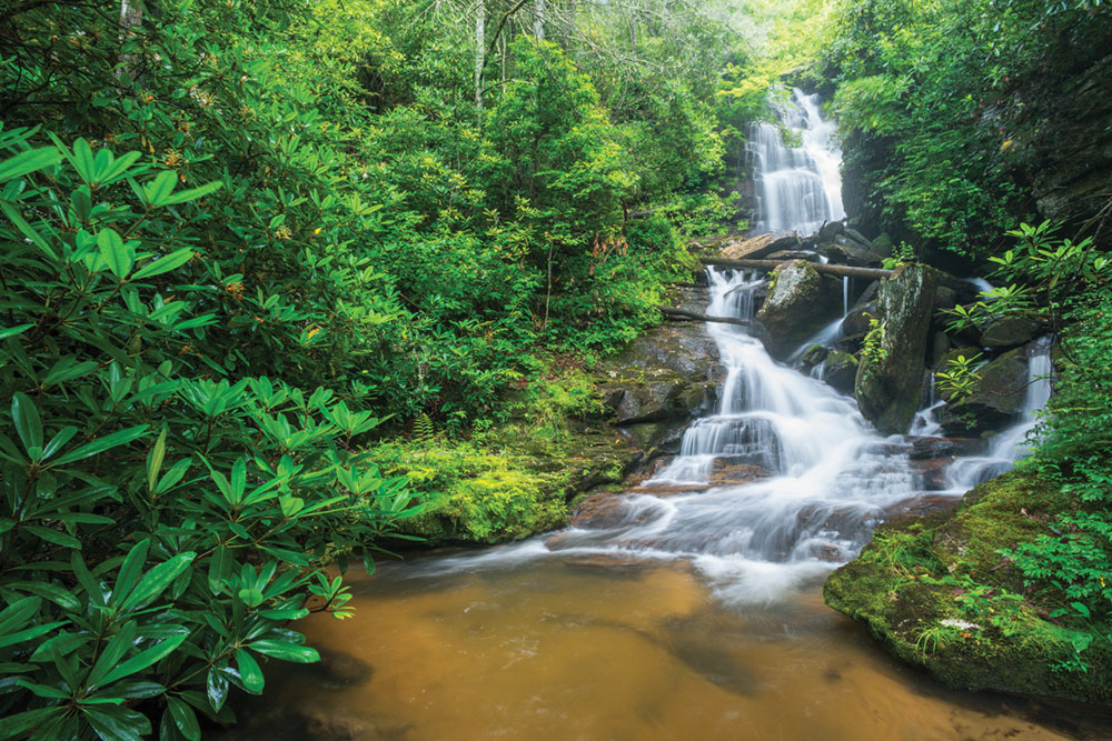
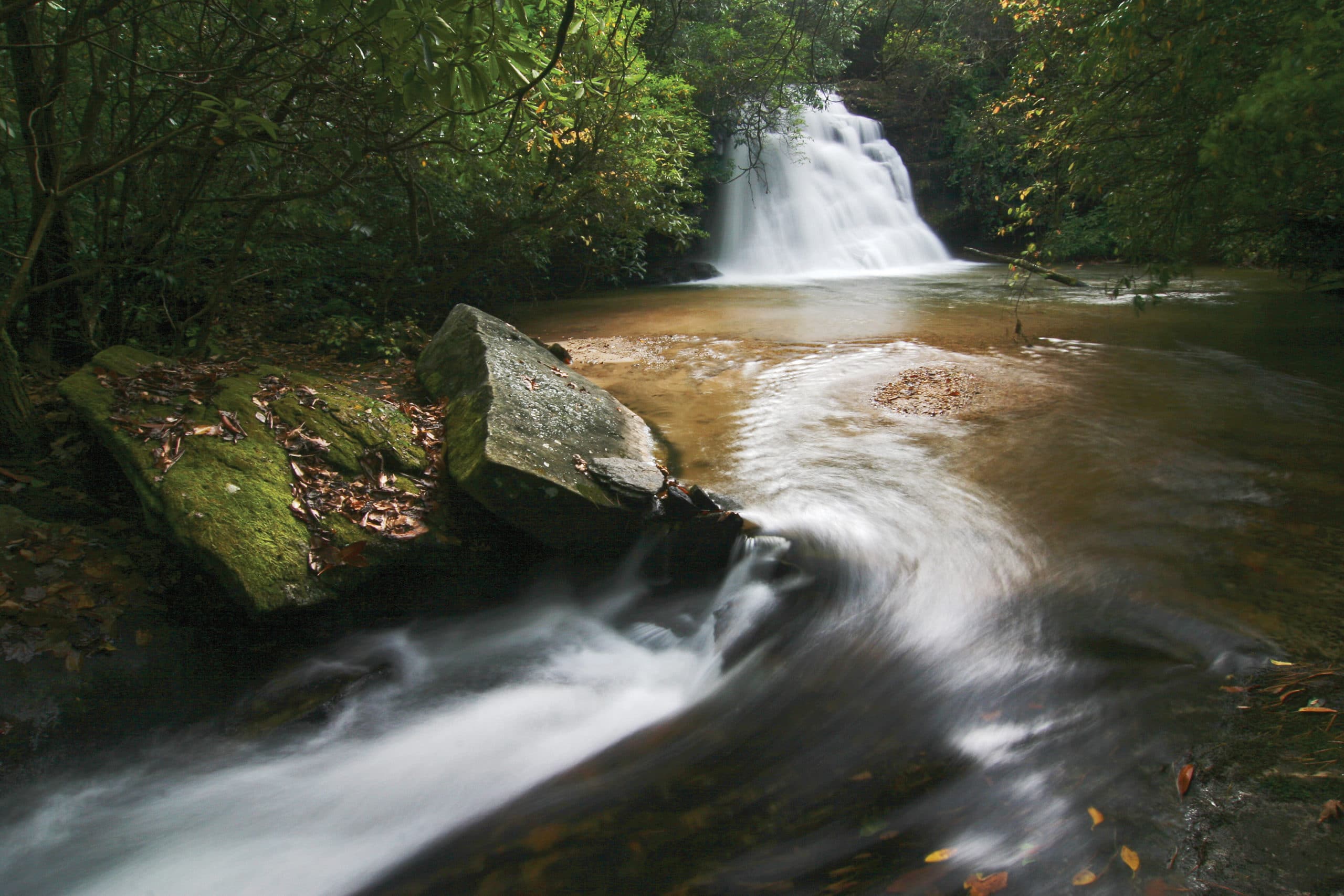
Like other hikes in Headwaters, the jaunt to Gravley Falls begins at an unnamed gate off of Glady Fork Road. Since Headwaters was owned by a timber company before Rep. Taylor’s family, this particular stretch is dominated by white pines. You can also expect to see some hardwoods and, after a heavy rain, to hear the south prong of Glady Fork running strong. At roughly half a mile, the trail awkwardly dead ends. Follow a faint spur trail through rhododendrons until you see the 15-foot falls. A sandy beach makes this a wonderful, clandestine swimming spot.
Reese Place Falls
- Difficulty: Challenging
- Length: 5.6 miles
- Elevation Gain: 750 feet
The trek to Reese Place Falls is heart-pounding, even before you get out of your car. To access this 60-foot cascade, you will drive down the very narrow and rutted Gum Gap Road—which should not be attempted without four-wheel drive—until you reach a large, red gate.
Once you find the elusive trailhead, you will follow a series of unnamed forest roads that twist through stands of white pines and crisscross Hickory Flat Creek. There are several Y-junctions, so a GPS unit or map is necessary. The hike then descends to the valley floor, where you will walk through dense thickets of rhododendron and doghobble toward the sound of roaring water. When the understory opens up, you will pass a smaller, 10-foot cascade before following a very narrow, treacherous path up to Reese Place Falls.
Cover photo: A small cascade in the remote Headwaters State Forest. Photo by Everette Robinson.


