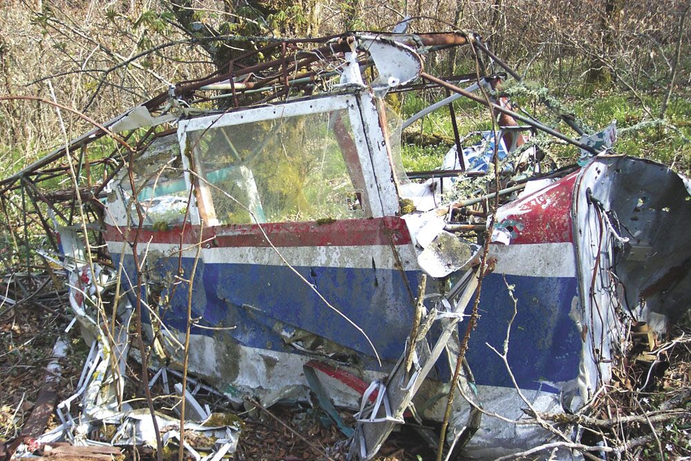
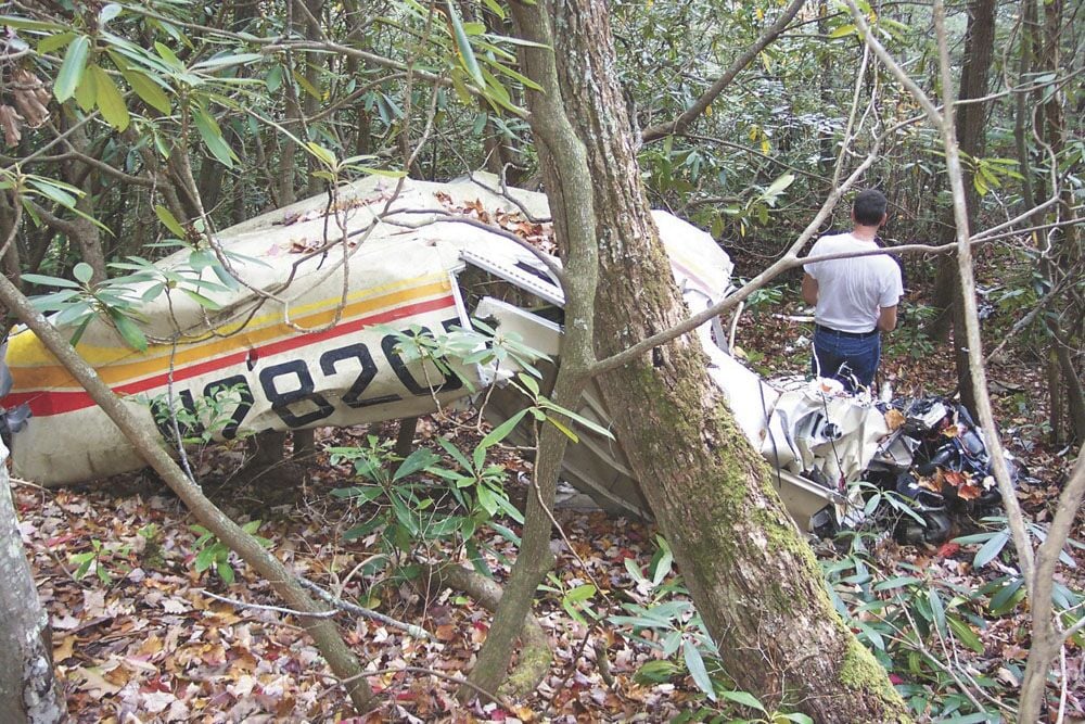
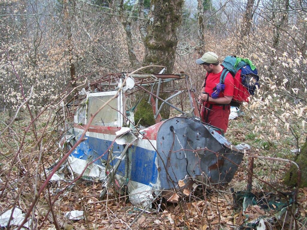
Some people hike for exercise; others are looking for views or waterfalls. Jeff Wadley hikes for plane crashes. The East Tennessee minister was a volunteer with the Civil Air Patrol for 30 years, leading search and rescue missions for downed planes throughout the mountains. Retired from the patrol, Wadley now hikes the Southern Appalachians looking for sites of planes that have crashed throughout aviation history.
How did you get into hunting for plane crashes?
Wreck chasing is sort of like geo-caching. For me, I started searching for planes as a volunteer cadet with the Civil Air Patrol when I was a teenager. The Civil Air Patrol started back in the 1940s. It’s all volunteers, made up mostly of pilots, who form ground search crews when a plane crashes.
Are there a lot of crash sites in the Appalachians?
Since the advent of the airplane, there have been 54 crashes inside the Great Smoky Mountains National Park alone. I’ve uncovered 20 more stories about crashes in the mountains just outside the park. There are little pieces of airplanes all over the Southern Appalachians. And there are about five or six aircraft out there that have never been located at all, still waiting for hikers to stumble across them.

That’s shocking considering our high population.
Planes can be very difficult to find. One of the FBI agents searching for Eric Rudolph in the 1990s was turning 40 during the search. His dad decided to fly down from Ohio with a birthday cake and presents. He crashed on the border of Joyce Kilmer in 1998. We looked for the crash every day for four weeks. I personally flew over the area a dozen times. We didn’t find it, and after a month, we had to suspend the search. I looked for the site for six years on my own time, and still never found it. Finally, a bear hunter stumbled upon it in a rhododendron thicket.
Is there something about the Appalachians that accounts for the high number of plane crashes?
A lot of the crashes are private pilots coming from flatlands. The number one problem in private plane crashes is spatial disorientation. They’re flying along and all of a sudden it gets misty, then they’re in the clouds and you don’t know which way is up or down, and they hit a tree or a mountain. But we haven’t had a crash in the Smokies for five years now. I think crashes in general are becoming less frequent. Pilots are safer, and the technology inside private planes is better.
Have any planes proved especially hard to find?
Absolutely. There was a World War II bomber that crashed near Whig Meadow back in the 1940s. I spent two years looking for it, using old photos to line up the mountains to determine where it might have gone down. Last January, I finally found little pieces of the plane. Even though the planes have been down for decades, you can still find evidence of the crashes?
Usually. Sometimes the crash debris is removed by the managing agency, and unfortunately, some hikers take them as souvenirs. Planes in the Smokies have literally disappeared over the years. If you find a crash site, leave what you find there and write down the “N” number from the side of the aircraft and report it to the land management agency or local law enforcement.
What are you looking for now?
I’m looking for a 1940s plane crash in the Slickrock Wilderness. Supposedly, some people survived the crash and walked out, but I haven’t been able to find the site yet. I’ll start looking after the first frost, after the yellow jackets are gone.
How do you know where to look?
I trace the plane’s flight plan. I also try to find weather and cloud cover data from that day. I can eliminate certain areas based on the flight plan. If the plane is flying north, there’s no reason to search the north side of the mountain, because it would have hit the south side.
What else have you seen while hiking off-trail?
Bear dens, marijuana patches, moonshine stills, people living in the backcountry…and a lot of plastic balloons. Those things are everywhere. BRO
CHASE THESE WRECKS
Here are two relatively easy wrecks you can find in your Blue Ridge backyard. But remember to be respectful. “To the families of the pilots, these crash sites are sacred ground,” Wadley says. “Treat them like a cemetery.”
Snake Den Ridge Trail, Great Smoky Mountains National Park, Tenn.
The Snake Den Ridge connects Cosby Campground with the Appalachian Trail, climbing 5.3 miles to the Smokies’ high elevation peaks. Just before the connection with the A.T., at mile 5, the trail passes the site where an F-4 Phantom collided with the mountain in 1984. Wreckage was scattered over 20 acres, and you can still find pieces of debris near the trail.
Appalachian Trail, Humpback Mountain, Va.
In 1964, a T-28B Marine trainer crashed into the side of Humpback Mountain close to the Blue Ridge Parkway in Nelson County and Augusta County, Va. Bushwhack the slope of the mountain beneath the A.T. between the Humpback Picnic Area and the side trail to the summit. The debris from the military crash sits about 200 yards from the A.T., and large sections of the plane can still be found, including the tail.


