Toughest Cycling Climbs in the Southeast
John Summerson likes the sadistic side of cycling—climbing. During his free time, the exercise physiologist at Wake Forest University School of Medicine in Winston Salem, N.C., hops on his steely steed and cranks up the steepest ascents in the South. He just released a Southern-specific version of his book series The Complete Guide to Climbing (By Bike).
“Ascending difficult hills is about struggle and perseverance,” says Summerson. “Conquering mountains is the heart and soul of cycling. From short and steep hills to long mountain grinds, the Southeast has climbs to engage and challenge any cyclist.”
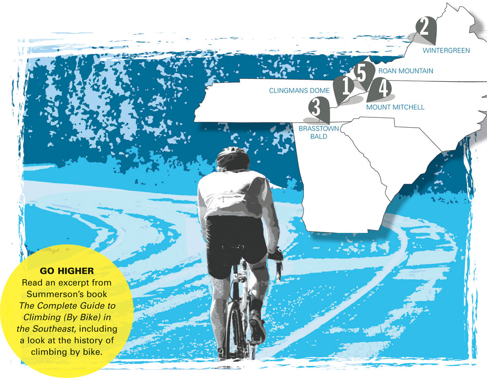
Here are Summerson’s nominees for the five toughest climbs in the region.
1. Clingmans Dome West, Tennessee/North Carolina
Total elevation – 4,826 ft
Length – 20.1 miles
Average Grade – 4.6% (8% max)
The west side of Clingmans Dome within Great Smoky Mountains National Park is a tough and scenic ascent. The grade is never steep on this one and about halfway up you pass through a unique 270-degree turn. At mile 13, the rider enters North Carolina at Newfound Gap and soon after turns right for some shallow miles to finish the climb at a parking area. There is some traffic on this climb, so tackle this one early or late on a weekday if possible.
Directions: From Gatlinburg, head east on Route 441 and enter the National Park. The climb begins at the Visitor Center on the right.
2. Wintergreen, Virginia
Total elevation – 2,664 ft
Length – 6.1 miles
Average Grade – 8.3% (13% max)
The climb to Wintergreen is likely the most difficult ascent in Virginia. Shallow to start, the grade jumps severely just before the turnoff to Wintergreen Resort at the two-mile mark. The grade continues in the double digits after the turnoff and then eases. It then ebbs and flows as you connect Wintergreen Drive and Devils Knob Loop Drive. There is a severe climb at the end before the grade eases to finish at an unmarked top just beyond Fern Court. The route is used for an annual hill climb race on its slopes.
Directions: From the tiny town of Wintergreen, head south on Route 151 for a few miles to Route 664. Turn right and head up the road for 2.6 miles. The climb begins at the junction with Falls Road on the right.
3. Brasstown Bald, Georgia
Total elevation – 1,824 ft
Length – 3.1 miles
Average Grade – 11.1% (21% max)
Made famous by Lance Armstrong and other pro cyclists in the Tour of Georgia, this hill starts out steep along a very tight, twisty road with multiple ramps of 10-15-percent grade along with a section of 20-percent grade about halfway up. The grade then eases and the road comes to an apparent end after 2.5 miles at a parking area. From there you must take a half-mile shuttle ride to the top (bikes not allowed; shuttle vans stop running at 6pm).
Directions: From Hiawassee head south on Route 17/75 for several miles to Route 180. Turn right on 180 and head 5.3 miles to 180 Spur on your right. The climb begins at the intersection of Route 180 and 180 Spur.
4. Mount Mitchell, North Carolina
Total elevation – 5,161 ft
Length – 24.1 miles
Average Grade – 4.0% (10%)
Mount Mitchell is the longest climb in the Southeast and has one of the greatest elevation gains of any climb in the United States. The first section (Route 80) contains many 180-degree switchbacks and gradually gets steeper as it nears the Blue Ridge Parkway. At the Parkway, turn left and climb through several tunnels along a moderate grade. After a descent, resume climbing and turn right on Mount Mitchell State Park Road. This final section is a bit steeper and the road dead-ends near the top of Mount Mitchell as the highest paved road in the eastern United States.
Directions: From Marion at the junction of Routes 221 and 70, head south on 70. Go approximately two miles and turn right on Route 80. After 2.8 miles on Route 80, pass Lake Tohoma dam and circle the lake to the small bridge to begin the climb.
5. Roan Mountain North, Tennessee/North Carolina
Total elevation – 3,097 ft
Length – 9.0 miles
Average Grade – 6.5% (10%)
The north side of Roan Mountain (along Route 143) has a very difficult and fairly steady grade ascent. Steeper over its bottom half, the road switchbacks through a tunnel of trees. At mile 7.5 (Carvers Gap), cyclists enter North Carolina and turns right on Roan Mountain Road for the final 1.5 miles. The climb ends just shy of the very top of Roan Mountain at the recreation area tollbooth.
Directions: From the small town of Roan Mountain on Route 19E head south on Route 143. Travel 143 for 5.5 rolling miles to begin the climb at Burbank Road.


