A slow tour of the region’s classic roadway becomes an action-packed Appalachian road trip
We started in early August. On a mountain road trip that some travelers knock out in a long weekend, our plan was to do the opposite. We would spend a leisurely 16 days cruising the Blue Ridge Parkway from north to south. I made reservations at six public campgrounds, each a two- to four-hour drive from one another. We had hiking shoes in the truck, kayaks and mountain bikes on the roof, and our new travel trailer hitched up behind.
For 469 miles, the parkway follows the crest of the Blue Ridge Mountains, connecting Shenandoah National Park in Virginia and Great Smoky Mountains National Park in North Carolina. Averaging over 15 million annual visitors, the parkway is the most popular unit of the National Park Service. Most people go for driving tours, mountain lodges, scenic overlooks, wine tastings, and a crowded fall colors season. Not exactly our scene, honestly, given we usually travel for more adventurous activities.
For years, we never considered the parkway a destination itself. On occasion, we might drive a short section on the way to other adventures. But the parkway does pass through some of the most scenic and rugged parts of the Appalachian Mountains. A closer look at the surrounding terrain revealed intriguing options, including hiking, paddling, mountain biking, and other side excursions. Once we had our camper, a new type of road trip seemed possible: progress slowly, set up basecamps, and try to beat the crowds by venturing outward.

James River, Appomattox, and Lynchburg, Va.
On day one, we drove south from Skyline Drive and continued onto the Blue Ridge Parkway. To reach the remote Milepost 0, we’d spent the prior week working north, with two basecamps, one to explore the Richmond area and another for long hikes in Shenandoah National Park. Thus, when we reached Humpback Rocks (Milepost 6), we decided to skip the steep trail to the ridgetop formation. Instead, we wandered an interpretive 1890s homestead before continuing south.
Despite it being a Saturday with mild weather, the northern roadway felt quiet and peaceful—far different than the southernmost sections we were familiar with. Along its length, the parkway doesn’t directly intersect with other highways but uses interchanges. Commercial vehicles aren’t allowed, and the speed limit is typically 45 mph or less. Not everyone follows those rules, but up here, at least, drivers mostly were.
Our first basecamp was Otter Creek Campground (Milepost 60.8) for three nights. This area doesn’t see much visitation, and the facilities seemed almost as old as the parkway itself, which was built over a 50-year period beginning in the 1930s. The nearby bridge over the James River (Milepost 63) is the parkway’s lowest elevation at 649 feet, and the warmer weather was perfect for some paddling.
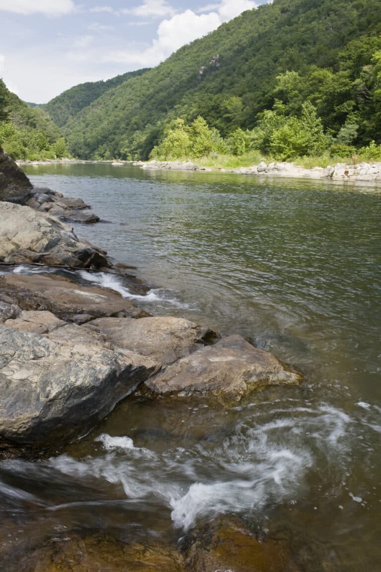
The next day, I pushed off in my kayak near the town of Glasgow. I’d heard about the Balcony Falls run for years. With five miles of class II+ through the forested James River Gorge, this is a whitewater classic among Virginia paddlers and beginners. We didn’t have our ducky, which my wife prefers for rapids, so I was probing solo. But a low summer flow around 750 CFS felt manageable, and I was soon welcomed by a local group.
The lone class III rapid is Balcony Falls, where the gorge narrows. We all came through with clean lines and continued downstream through fun boulder gardens. When a dark storm rolled in, we lowered our heads and paddled through driving rain. My wife was waiting at the truck, and the afternoon weather sent us west for drinks and dinner at the excellent Outpost Taproom of Devils Backbone Brewing Co. in Lexington.
On day three, we stopped by the Otter Creek Visitor Center to see a preserved section of the historic Kanawha Canal. There we met Justin, a tour cyclist who was riding the entire parkway on his way from Washington D.C. to his small farm in rural Georgia. We wished him luck before heading out on a side trip.
The visitor center exhibits at Appomattox Court House National Historic Park were fascinating, but the best part was walking through the restored 19th century townsite. Afterward, we explored downtown Lynchburg for a history walk and pub crawl. Highlights included a sweaty stair climb to the Lynchburg Museum in the Old Court House, followed by air-conditioned stops at Three Roads Brewing and Starr Hill on Main. Our James River basecamp was a winner, and we’ll be passing this way again someday.

Roanoke, Va., and Explore Park
On day four, we drove two hours south to Roanoke. We had high hopes for camping three nights at the county operated Explore Park (Milepost 115), which touts its 1,100 wooded acres as an adventure destination. The disc golf course was good fun, and the quiet park’s onsite brewpub made for a nice evening with fun people at a historic 1800s tavern. But the park’s RV campsites were oddly cramped, and the mountain bike trails felt like riding on staircases made of roots. With several child-focused zones, including the animatronic T-Rex Trail, the park seems better-suited for day-tripping families or those staying in rental cabins.
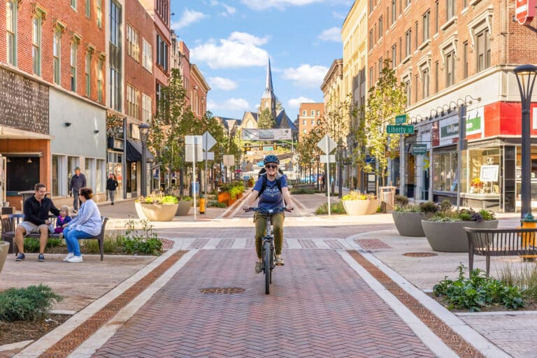
We had a nice time exploring the friendly mountain metro. We walked around Mill Mountain Park, home of the iconic hilltop star. We checked out the comprehensive Transportation Museum. We wandered around the quaint downtown to solid breweries and restaurants, including the Olde Salem Brewing Co. and Nawab Indian Cuisine.
On day five, we hoped to mountain bike the area’s top trail system at Carvins Cove, but heavy rain had other ideas. My wife opted for an inside day. I put on my splash top and paddled the Roanoke River Gorge, a three-mile class II run along the northern boundary of Explore Park. The typical put-in requires a steep quarter-mile hike from the parkway to river level. Other than the channelized rapid of Little Niagara, the run was pretty scrapey at summer levels and likely better in the spring.
One highlight was an afternoon side-trip to nearby Booker T. Washington National Monument, which preserves the plantation where the African American leader was born enslaved and departed from after the Civil War. Outside the excellent visitor center, walking paths lead through restored buildings and a demonstration farm. It was a quiet day at this little-visited monument, and we hung out with the ranger while she fed the animals.
Doughton Park and New River State Park
Day seven involved a longer drive with brief stops, including a short walk at Rocky Knob (Milepost 167), a self-guided tour of the historic Mabry Mill (Milepost 176), and a nice museum at the Blue Ridge Music Center (Milepost 213). Thus far, we’d found the 217 miles of the Blue Ridge Parkway in Virginia to be surprisingly quiet, other than a busier section through Roanoke.
Once we crossed into North Carolina, traffic increased, and impatient drivers began tailgating. Due to construction closures on the parkway, we detoured through busier towns. On one hectic stretch of highway, we passed Justin. He was standing on the shoulder, next to his tour bike, looking a little tired. Unable to stop, I honked and waved hello.
Fortunately, after backtracking on the parkway, we found Doughton Park (Milepost 238) to be a picturesque landscape of rolling meadows and forests. We set up for three nights in a nice campground filled with regulars who walked laps together around the loop each night. During our stay, we learned that Doughton Park was much quieter than usual given the parkway closure just to the north. Day eight was spent hiking 10 miles through the breezy park, which offers mild summer temps due to an elevation around 4,000 feet. We passed fields of wildflowers, enjoyed open vistas, and stepped inside the restored Brinegar Cabin.
On day nine, we side-tripped to New River State Park for a warm Sunday float trip. The five-mile run from Gentry Road to the U.S. 221 access was great, with classic Appalachian scenery, just a handful of fellow floaters, and steady current.

Linville Falls and the Black Mountains
On day 10, we caught up with Justin right after the famous Lin Cove Viaduct (Milepost 304). He described a harrowing ride on the recent detour. We were like old pals now, laughing about the simple days on the mellower parkway in Virginia. We all camped at Linville Falls (Milepost 316) for one night, where we hiked the short trails together to waterfall overlooks, while sharing stories of past adventures. For dinner, we devoured a Dutch oven meal of baked pesto. The last time we saw our new friend was on day 11, outside the Museum of NC Minerals (Milepost 331) where a small crowd had gathered to hear his tales. Hopefully, we’ll cross paths again someday.
From there, my wife and I diverted off the parkway to the popular Black Mountain Campground for three nights. On day twelve, we drove the switchbacks up to Mount Mitchell State Park to see the highest summit on the East Coast at 6,684 feet. A chilly but worthy hike took us through dense fog, slick rocks, and scraggly spruce-fir forest along the rugged spine of the Black Mountains.

Pisgah National Forest and Brevard, N.C.
On day 13, we resumed towing our camper along the parkway. We made a hiking stop at busy Craggy Gardens (Milepost 364.6) and dropped into the Folk Art Center gallery (Milepost 382). Then we zipped through Asheville. We were in familiar territory again, having driven the parkway several times around Pisgah National Forest.
Our typical stop is the lush Davidson River Campground on US-267, which makes for a great off-parkway basecamp near Brevard. However, if that’s full, a ridgetop option is Mt. Pisgah Campground (Milepost 408). Highlights around here are too numerous to mention, but we often mountain bike at Dupont State Forest, which mixes fun single-track with gravel routes leading to cascading waterfalls. At night, we might head downtown to Brevard Brewing Co. and walk to dinner nearby, including the casual Mayberry’s. Or, near the edge of town, another top brewpub with outdoor beer garden is Noblebrau.
Closer to the parkway, we’ve walked the pleasant paths at the Cradle of Forestry, which wind through the woods of a historic forestry camp that’s now an outdoor-indoor museum. Meanwhile, there are several day-hiking options on the parkway south of US-276. The trails at Graveyard Fields (Milepost 418.8) are moderate, winding through a rugged creek valley with several waterfalls. Or turn west onto Black Balsam Road (Milepost 420.2) and hike the steep Art Loeb Trail to Black Balsam Knob and Tennent Mountain for panoramic views of the surrounding highlands.
On a prior trip, at the southern end of the parkway we continued east into Great Smoky Mountains National Park for more adventures. This time, we turned south toward a final basecamp near the Nantahala River for a weekend of paddling and mountain biking with friends. Along the way, we made a last stop at Richland Balsam Overlook (Milepost 431). At 6,053 feet, it’s the highest point on the parkway. Despite going slowly, our 16-day road trip felt like a whirlwind.
Cover photo: All photos by Mike Bezemek


