A Vibrant Outdoor Scene Evolves in a Historic Area of Ancient Rock Arches
Our first stop felt like exploring a historic treehouse. Walking into Natural Bridge State Resort Park, my wife and I passed a pond filled with snapping turtles and crossed a rickety suspension bridge. From there, a series of trails—with stone stairs, wooden walkways, and optional ladders—zigzagged up the forested ridge toward the famous rock arch.
It was Wednesday morning before Memorial Day, and the park seemed quiet. The resort area’s lodge, pool, and shops were mostly empty before the holiday weekend. We joined scattered hikers and families heading uphill. A quick detour led to the precarious Balanced Rock. Another stop was a tiny museum, straight from the mid-20th century, with taxidermy animals and logging dioramas. One couple walked inside, sniffed the musty air, and walked right out. But we appreciated the context. Natural Bridge was one of Kentucky’s first state parks, with visitors originally coming by train in the 1920s.
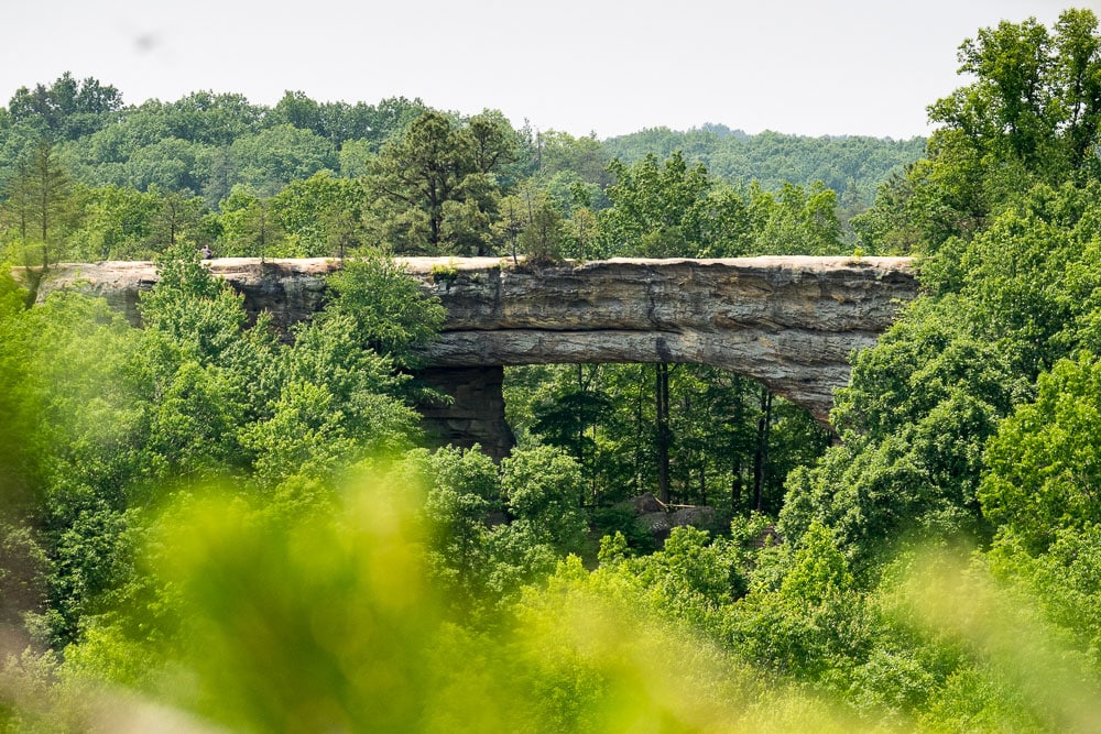
After a short but steep ascent, we passed underneath the park’s namesake feature. Squeezing through a narrow crevice, we arrived atop the impressive 80-foot span. Technically it’s a sandstone arch, but the bridge name works because people can walk across. A few groups of college kids were sitting along the flat top and admiring the view. In the distance was the Red River Gorge Geological Area, a popular 45-square-mile subunit of Daniel Boone National Forest, which holds stunning sheer cliffs that line the upper slopes of the forested ravines.
Crossing the bridge, we made a tour of the plateau top, including Lookout Point. The quirkiest thing was the Skylift, a fancy name for an old two-seat chairlift. A bored-looking young woman was sitting inside the fence, so I asked when it was built. She shrugged and glanced at her 20-something boyfriend.
“Sixty-seven,” said the operator. With straight shoulder-length hair, he seemed like a time traveler from the same year—the 200th anniversary of Daniel Boone’s first visit to the area.
At Lover’s Leap, we chatted with a young Kentucky couple dangling their feet over the ledge. Far below was Miguel’s Pizza and campground, a hub for climbers and hikers. More visitors, mostly college kids from Ohio, arrived to take photos. One guy said he was from Columbus, which another dude claimed was “badass.” My wife mouthed the word, badass. We were in uncharted territory—at least for us. The far side of the Appalachians.
Where the Red Could Grow
After hearing about the Red River Gorge for years, we’d finally made the trip. What some call the Red is known for its hundred natural arches, dozens of hiking trails, a section of National Wild & Scenic River, and abundant rock climbing. It falls within a larger region of Appalachia that’s seen more busts than booms, often related to coal mining. To entice outdoorsy visitors, 41 counties in Eastern Kentucky have rebranded the area as the Kentucky Wildlands.
Meanwhile, the National Park Service is conducting a feasibility study of the 14,000-square-mile region for designation as a National Heritage Area. Lesser-known NHAs don’t involve federal land acquisition. Instead, the park service assumes an advisory role to help regional entities preserve the landscape and coordinate recreational opportunities. Ideally, an NHA boosts national recognition, tourism, and the regional economy.
During the pandemic, Red River Gorge visitation increased to about one million people per year, mostly between Memorial Day and Labor Day. Simultaneously, there’s controversy over attempts to build a high-end resort on 800 acres near Slade. Local critics worry it will cause overcrowding and create a mini-Gatlinburg, referring to the bustling Tennessee tourist town outside Great Smoky Mountains National Park. Clearly, the gorge is at a crossroads, and we wanted to visit before whatever comes next.
Tunnel Vision
We spent the afternoon making a clockwise loop through the gorge. Our first stop was unintended, at the historic Nada Tunnel. Excavated with dynamite around 1910, the tunnel was originally used by a logging railway. Today a single lane leads through jagged sandstone. Coming from the west side offers limited visibility, so I cautiously pulled up to the opening, saw headlights, and slowly reversed. So did some curious pedestrians and the car behind. When the oncoming vehicle passed, I rolled up to the dark maw again. Another pair of headlights was entering! This process repeated a few times, with a lengthening line of vehicles, before we could drive through.
Beyond the tunnel we were finally inside the narrow gorge, following a twisty road with forested slopes rising above. We passed several trailheads and crossed the bridge marking the end of the Wild & Scenic section. The Red River was low. But driving upstream, we did see paddlers floating down. We stopped for a short hike at the Sheltowee Connector trail and joined a string of teenagers shuffling to a swimming hole.
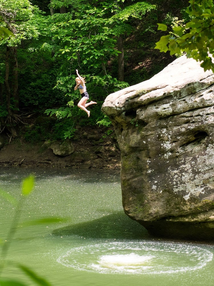
“I think it’s a hangout spot,” I said. My wife nodded like this was the most obvious comment in the world. Past the swimming hole, we reached the junction with the Sheltowee Trace. The suspension bridge was half-collapsed from a recent tree fall, but the forest service plans to rebuild it. The Sheltowee Trace National Recreation Trail runs for 319 miles, mostly through national forest backcountry. Throughout our visit, we repeatedly crossed paths with pleasant sections of this lush winding trail. On our return walk, the swimming hole was even busier, with kids daring each other atop a massive jump rock.
“I think it’s a hangout spot,” teased my wife.
Other short hikes took us to Sky Bridge, Princess Arch, and Chimney Top overlook. Each was interesting, but the bigger adrenaline spike came from driving the paved byway. It’s less a two-lane than a 1.8-lane. When cars came speeding around blind corners, and everyone swerved, that two-tenths of a lane seemed significant.
Pizza was worth the hype at Miguel’s, and during dinner I did more research. Most new visitors come to the Red with family or friends, and information for first timers is limited. So, my wife sent an inquiring text to a friend who knew the area.
River Runs Low
Our second day was about paddling. More accurate: we increasingly walked down a shallow riverbed. After dropping my wife and kayaks at Copperas Creek put-in, I drove to take-out at Red River Adventures. Aboard the shuttlebus was a lone family from Oklahoma, on a celebratory adventure with the eldest son, a recent graduate from the nearby University of Kentucky in Lexington.
The youthful outfitter who drove the shuttle didn’t sugarcoat. The Red River was the lowest he’d ever seen it before Memorial Day. A combo of low precipitation and hot dry weather. We might have to drag past, say, 10 or more shallow spots. Having experienced worse, we went anyways.
After launching, the first mile was a gem. Clear waters, deep pools, and shallow but channelized chutes. Trees leaned over the river, where occasional boulders rose like pedestals. But as we progressed, the riverbed widened and became even shallower. Eventually, we caught up with a large group of surprised locals, with everyone walking boats for quarter-mile segments through sand shoals and gravel riffles.
After four determined hours we finished the eight miles. The nearest USGS gauge, about 25 miles downstream in Clay City, reported a flow of 100 CFS—way too low. I wouldn’t paddle this river again without twice that. At cushier levels, earlier in the spring, it should be an excellent class II run.
Wilderness and BBQ
On the drive back, we hiked a short loop into the 20-square-mile Clifty Wilderness. Beyond scenic Creation Falls we reached the impressive Rock Bridge. Spanning a creek, this is the Red’s only true natural bridge. With more time, we would have continued on the Swift Camp Creek Trail through a beautiful fern-filled canyon. But dinner beckoned.
We stopped by our camper at Koomer Ridge, a nice USFS campground that lacks a dump station. Hence, we were showering in a bathroom block that felt like the spider house at a zoo. When my wife ran out with damp hair, I had to ask.
“Just three big ones tonight,” she explained. “Only one pursued me.”
“Do I need to beat this spider up?” I suggested.
“That would be nice.”
We were running late. Skybridge Station, a popular brewpub with an onsite climbing guide service, had just closed its kitchen. Over a beer, the friendly bartender pointed us toward another option. But soon we were doubting his driving directions, which took us off the highway, down a gravel road, and past a spooky graveyard. Suddenly, the illuminated Red Point BBQ emerged on a hilltop. This newer restaurant was awesome. My wife got a cider and grilled portobello. I got a local hazy and brisket. We split cornbread, coleslaw, and mac & cheese. On the surrounding hundred acres, they’re building a disc golf course, which still needs work, but will definitely be worth a longer visit when finished.
More to Explore
Come Friday before Memorial Day, the gorge was different. Sporty SUVs and lifted pickups patrolled the campground, hunting for sites. Roadways were filling with tourists careening between highlights. We’d learned to skip the congested Nada Tunnel by driving the byway counterclockwise into the gorge.
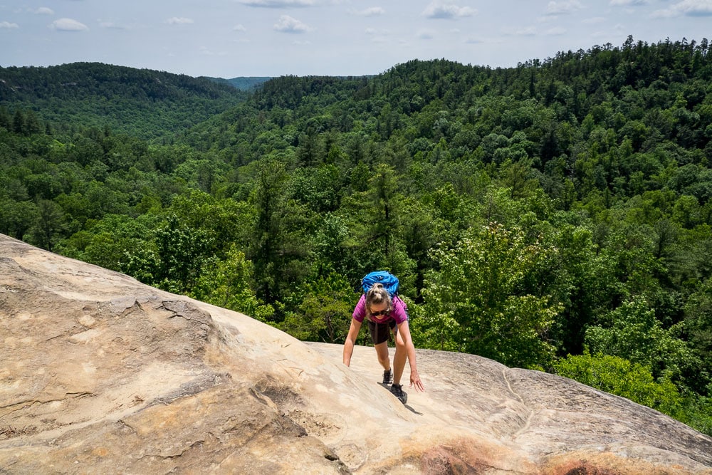
Our friend had recommended Indian Staircase. It’s one of many unofficial hiking routes, which roughly match the total mileage of the official trails. We hiked up Bison Way Trail to the Sheltowee Trace and continued off-trail up a ridge to faint steps carved into bare sandstone bluffs, made by saltpeter miners. I’d brought a rope, but my wife scrambled like a champ without it. Up top, we searched the woods until finding the way to a large rock shelter, a site used long ago by native people. Over centuries, these natural alcoves eroded into the cliffs from freeze-thaw weathering and runoff events. Sometimes, the backsides eroded away, too, creating the famous natural arches.
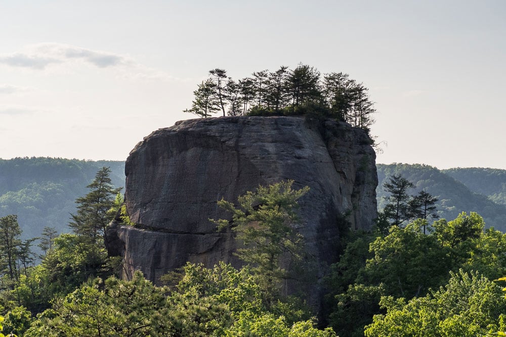
While the staircase was our favorite adventure, there was more to explore, including a stop by the educational Gladie Visitor Center and historic homestead. Then a hike along forested Auxier Ridge to Courthouse Rock, passing dozens of college-aged kids backpacking, camping, and swinging in colorful hammocks.
This area could be headed for a bigger season of change, but for now summer at the Red had arrived.
Cover photo: The namesake arch of Natural Bridge State Resort Park. Photo by Mike Bezemek.
