Why Fall is the Right Time for a Road Trip on the Carolina Coast
The Outer Banks—a string of scenic barrier islands about 20 miles off the coast of North Carolina best-known for lighthouses, shipwrecks, and pirates— have always intrigued me. But instead of booking a beach house like everyone else, my wife and I decided to explore the full scope of the tranquil coast’s scenic landscape and adventure opportunities in one straight road trip. So last year, during a purposefully plan-free Thanksgiving, we packed the car and headed to OBX during the less-busy fall season.
The first few days of our trip took us to Washington, D.C., where we bundled up and walked the chilly National Mall while visiting monuments and museums. At the National Air & Space Museum we viewed the actual 1903 Wright Flyer, the world’s first powered airplane. This was the perfect segue into our first stop on a north-to-south tour through the Outer Banks. The next day we drove south along the mainland and crossed a bridge onto Bodie Island.
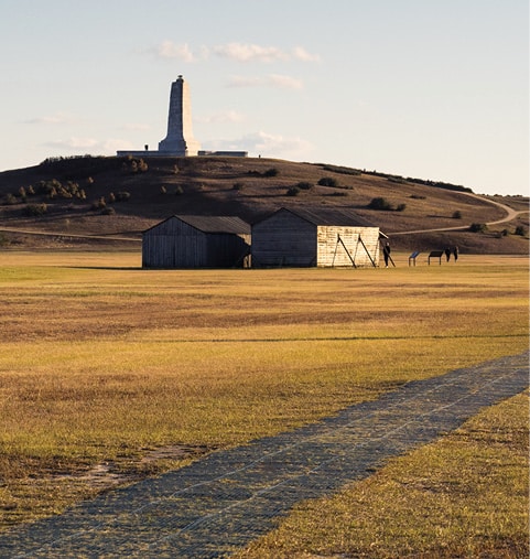
Wright Brothers National Memorial is an NPS site in Kill Devil Hills just south of Kitty Hawk. This small park unit preserves the location of the Wright Brother’s historic first flight. After touring the visitor center museum, we walked outside to inspect a replica of the wooden hangar used by the brothers.
On December 17th, 1903, on what was then a nearly level expanse of sand, Orville lay flat at the controls between two rear-pointing propellors. The boxy aircraft moved down a wooden track and took to the air. The Flyer flew just under seven mph, but combined with an icy 27 mph headwind, the result was enough lift to stay about 10 feet high for 120 feet. The brothers took turns making three more flights that day.
Today, the grounds are grass-covered, and the park service has installed a walkway with stone monuments that mark the distance of each flight. The second and third attempts reached 175 feet and 200 feet, respectively. During the fourth flight, Wilbur lasted the longest. A remarkable 59 seconds in the air, flying 852 feet before a minor crash grounded the Flyer. From the fourth landing spot, we retraced our steps and continued up to the granite monument atop Kill Devil Hill.
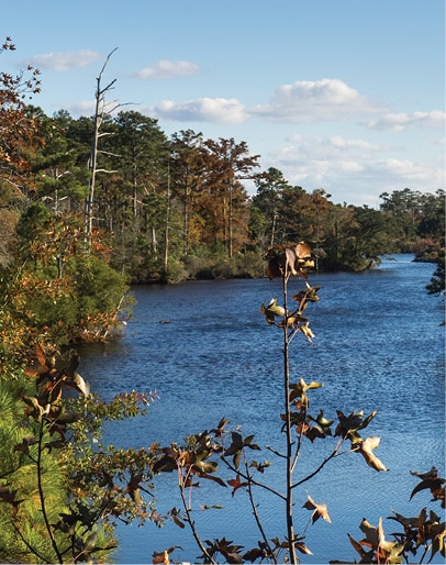
Continuing our drive south, the next stop was Jockey’s Ridge State Park, where we set off on a nature trail through the dunes. With some cresting at heights of 80 to 100 feet, these are the tallest active dunes in the eastern U.S. As Albemarle Sound came into view, we could see the outline of Roanoke Island, where we would stay for two nights.
The next morning, we went to the NC Aquarium to learn more about the aquatic ecosystems of the Outer Banks. One highlight was the sea turtle rehabilitation center. Every year, sea turtles like loggerheads emerge from the sea and lay their eggs in the sand along the Outer Banks, typically from May through September. About two months later, the hatchlings break through the eggs and sprint for the surf. In the rehab center tanks, there were several turtles of various ages and sizes recovering from various ailments before returning to the wild.
Roanoke Island is best known for the 16th-century disappearance of the first English colony in North America. Today, the site of the Lost Colony is preserved at Fort Raleigh National Historic Site. After learning more about the mystery in the NPS museum, we explored the grounds on a nature trail that led to a star-shaped earthen fort, reconstructed to resemble the original one built in the 1580s. Centuries later, during the Civil War, the Union-occupied island became home to formerly enslaved African Americans. Before we left, we hiked the 1.25-mile Freedom Trail out to the site of the 1860s Freedman’s Colony.
Back in the small downtown of Manteo, named for a 16th-century Native American guide who helped the English colonists, we wandered around the waterfront. After crossing a small bridge, we stumbled across yet another indoor-outdoor museum, the Roanoke Island Festival Park. Outside exhibits included recreations of an Algonquin coastal village, including two long houses made from lashed poles and woven bark. Nearby was a recreated settlement site of what the first English colony may have looked like, including a blacksmith shop with a costumed interpreter. Finally, we boarded the sea-worthy Elizabeth II, a detailed recreation of an English merchant ship from the Roanoke expedition of 1585, which floats in the Manteo harbor.
The next day was Thanksgiving, and we continued driving south through Cape Hatteras National Seashore, best known for its undeveloped beaches and a series of historic 19th-century lighthouses. The weather warmed throughout the morning, as an early fall cold snap gave way to the typical low 60s of November days.
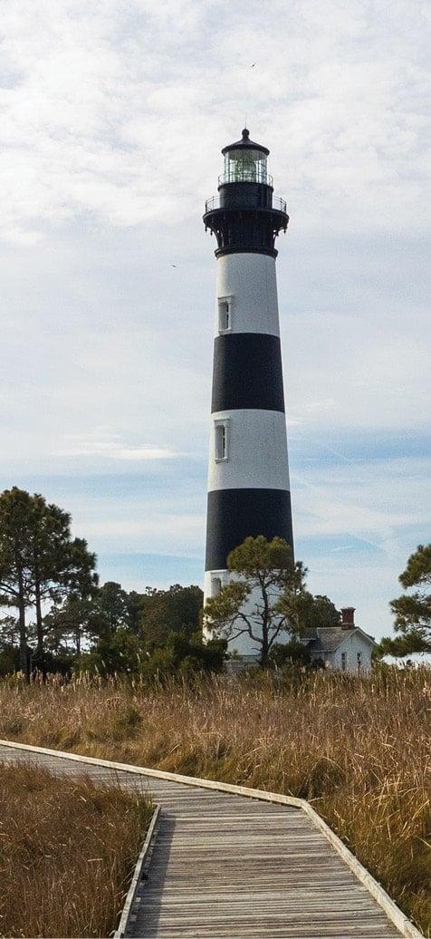
The first stop was Bodie Island Light Station, followed by Cape Hatteras Light Station, with its distinctive diagonal black and white stripes. Originally built right next to the beach, steady sea encroachment and shoreline erosion threatened the structure. In 1999, the entire tower was lifted onto steel beams and slowly moved inland 2,900 feet to its present location. After visiting the small museum near the lighthouse, we walked the relocation path to see the former location not far from the surf zone.
We drove a few miles farther to the southwestern tip of Hatteras Island and lined up for the mid-day vehicle ferry to Ocracoke Island. Within sight was the Graveyard of the Atlantic Museum, closed for the holiday, which focuses on the maritime history and shipwrecks of the area, caused by the constantly shifting sand bars and inlets of the Outer Banks. While the point-to-point distance between islands is only a few miles, the ferry has to follow a roundabout route through treacherous channels that takes about an hour. On the way, we watched a pod of dolphins playfully swimming and jumping alongside the ferry.
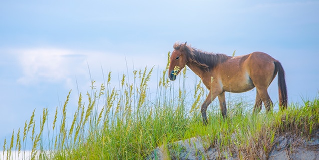
Our final destination in the Outer Banks was two nights on Ocracoke Island, a regular haunt of the infamous pirate Blackbeard that still can only be reached by boat. Other than the village, the majority of this island is part of Cape Hatteras National Seashore. Once off the ferry, we made a few stops along the 14-mile drive south. The so-called Pony Pen is an NPS corral filled with the descendants of wild horses that escaped from early Spanish explorers. We checked out the campground for a future warm-weather visit, and we walked the short Hammock Hills Trail through the forest to the edge of Pamlico Sound.
After checking into our near-empty hotel, we explored the quiet village neighborhoods on foot. Among the mix of resident homes and vacation rentals, most houses had decks that appropriately rise high above the rooftops like crow’s nests. By now, we’d worked up quite an appetite for a Thanksgiving dinner. But on an island with limited off-season restaurants to begin with, during a last-minute holiday trip, dinner out had proved impossible. Thus, we’d come prepared with a grocery bag and cooler filled with a variety of no-cook delectables. Fresh bread, a few cheeses, olives, pepperoncini, hummus, lunch meats, and brownie bites for dessert. We called it Snacksgiving. And, yes, we were still hungry at the start of our final full day in the Outer Banks.
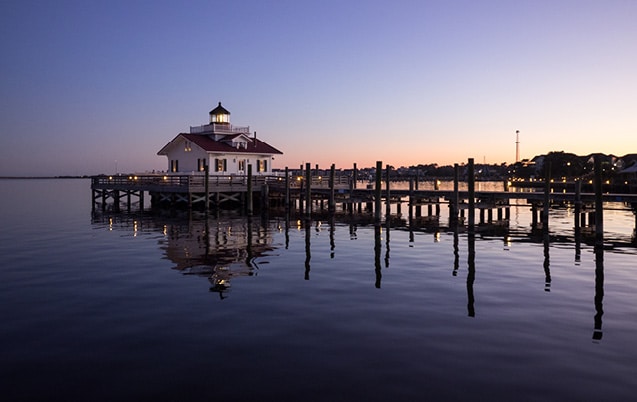
Photos courtesy of Getty Images
Ocracoke did not disappoint in terms of highlights—and quirkiness. The only open coffee shop was inside some locals’ house. We ordered through a window from their porch, and for all we know, they made the quality coffee while still in bed.
We walked village roads and a nature trail through coastal forest out to Springer’s Point on the sound side. Then we checked out the quaint Ocracoke Light Station on our way over to the seaside, where we walked a few of the 15 miles of undeveloped beach. Afterward, we mingled with the locals at the excellent 1718 Brewing, named for the year Blackbeard was killed in a naval battle just off the island.
That evening we walked out to Silver Lake Harbor, but strong winds caused the cancellation of the parade of boats, which would have been decked out in holiday lights. It was the final night of a great impromptu trip. Tomorrow we’d take the ferry south and drive along the mainland past the southernmost Outer Banks. These three undeveloped and bridge-free islands are part of Cape Lookout National Seashore, which we’d have to visit another time. But for now, our final stop was the Ocracoke Oyster Company to make up for lost meals.
Photo by Mike Bezemek
