“Did you get my email about bringing water shoes?”
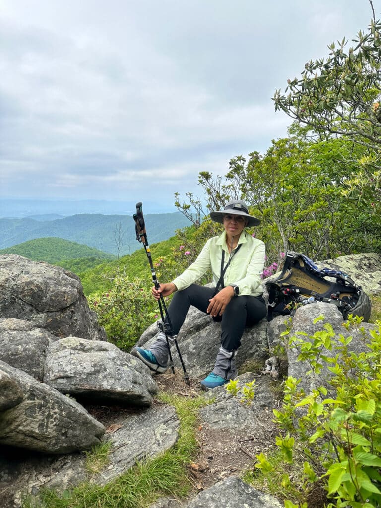
That’s the first thing Jerry Span says to me when I meet him at the Fontana Marina in the far western corner of Great Smoky Mountains National Park. I did not get his email. He seems disappointed. “We’ve got river crossings,” he says. “A lot of them.”
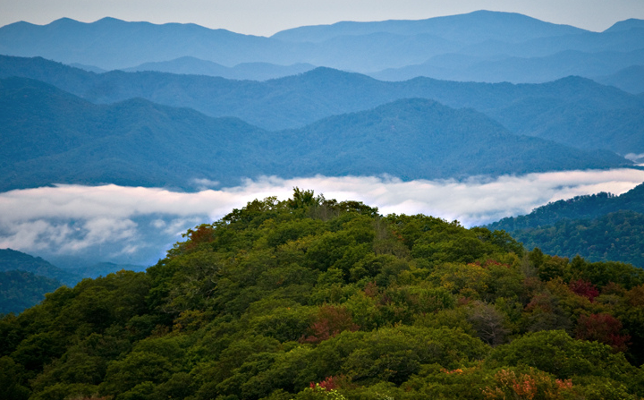
Span is taking me on a backpacking trip through what is arguably the most remote region of the Great Smoky Mountains National Park. The word “remote” isn’t usually used to describe any portion of the Great Smokies, which sits within a three-hour drive of some of the biggest cities in the South. The park is sandwiched by bustling “gateway” towns, hosts one of the busiest sections of the A.T., and is surrounded by major interstates and highways. After all is said and done, the Smokies see nine million visitors a year, making it the most visited national park in the entire country. During peak tourist season, visitors stand in line at popular overlooks, waiting to take the exact same picture as the guy in front of them.
But we’re headed to a section of the Smokies that rarely attracts visitors at all. We’re exploring a 44,000-acre section of the park called Hazel Creek that was separated from the rest of the world when the Tennessee Valley Authority flooded the Little Tennessee River to create Lake Fontana. At one point, Hazel Creek was a bustling timber town, complete with a softball field, school, even a movie house. Before that, copper mines dotted the landscape. But when the national park acquired the land, all remaining residents were relocated. After the waters of the Little Tennessee rose, all roads into the area were flooded.
Today, Hazel Creek is flanked by miles of roadless park land on one side and the 12,000-acre Fontana Lake on the other, leaving only two ways to get to Hazel Creek: by boat or by foot. Few people have access to a boat and even fewer are willing to hike the ten miles of lakeshore trail it takes just to reach the Hazel Creek trailhead. To really explore the area, you have to hoof it for several more miles inland. It is an area filled with historical ruins, trout streams, rugged trails, and expansive views, and it is left relatively untouched by the nine million visitors that converge on the Smokies.
“Occasionally, you’ll see a fishermen back here, but that’s it,” Span says as we cross over Hazel Creek, a wide, powerful stream that cuts through the valley floor before joining Fontana Lake. As the outdoor recreation manager for nearby Fontana Village, Span has spent the last two years exploring the Hazel Creek watershed. He’s a young, skinny man with a bushy Civil-War-esque beard, whose exploration is fueled by an intense passion for Appalachian history. Span collects stories about the families and companies who once occupied the area, then bushwhacks through the thick forest looking for any remaining artifacts.
We take a pontoon boat deep into one of the fingers of Fontana Lake, tying up at the mouth of Hazel Creek. The boat shuttle cuts off ten miles of hiking. The fact that you have to take a boat into the area is a controversy that has raged among locals for decades. In 1943, when the park acquired the land that was once the Hazel Creek community, the National Park Service promised Swain County residents a road would be built so locals could visit their ancestors still buried in small cemeteries deep inside the park boundaries. This is the famed North Shore Road, which was never built because of the devastating environmental impacts the construction would have caused. Without the road, locals visit their ancestors by boat and jeep shuttle.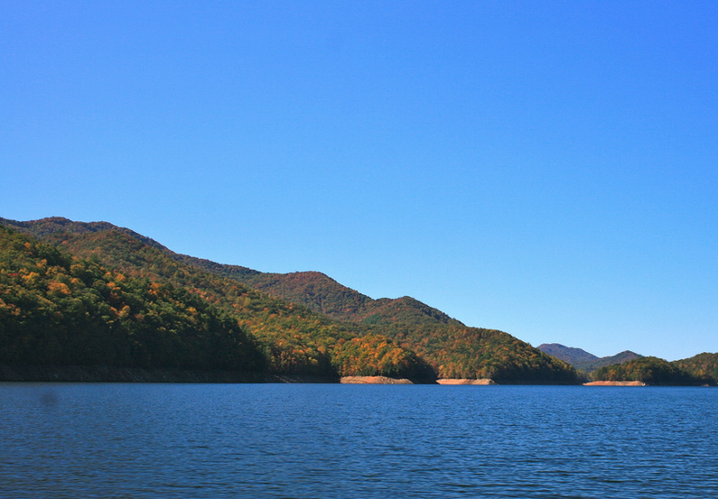 This is why the 5.5-mile Hazel Creek Trail that Span and I are hiking isn’t really a trail. It’s a well-maintained road-bed covered with crushed gravel that serves as the main thoroughfare into the cemeteries. It’s a bit disappointing to take a boat shuttle into a narrow cove, cross a rushing river to get to one of the most remote trailheads in the entire national park, and then spend the afternoon hiking crushed gravel. We even pass two jeeps that the park service uses to transport relatives to the cemeteries. Half a dozen times a year, local families will stage elaborate ceremonies at their family cemeteries, called “Decorations.” They bring in large spreads of food scattered over portable picnic tables. They tell stories, play bluegrass music. Imagine an Irish wake 100 years after the honoree’s death. Other than the occasional fly fisherman, the Decorations are the most traffic Hazel Creek ever sees.
Along the river bank, we hike past old schools that are now stands of hardwoods. Softball fields that were turned into campsites. Boardwalks that are now trails. The Ritter Lumber Company (one of the many companies to occupy Hazel Creek) would scour the country looking for suitable timber, establishing portable villages when they found an ideal location. After the timber was used up, Ritter would deconstruct the town and move on to the next locale. When Ritter Lumber Company abandoned the Hazel Creek area, the leftover scraps of the town were burned by the park service. Only a few brick fireplaces, foundations, and the occasional cabin remain today. If it weren’t for the obvious road grade we’re hiking, we would never know there used to be a thriving community that once called these valleys and ridges home.
“I love seeing things like that,” Span says, pointing out a tree that’s growing through the heart of an old, rusted bucket.
“This town was created to destroy the forest, and now the forest is taking over.”
From the Hazel Creek Trail, we bushwhack to a few of the old copper mines that used to occupy the area. It’s been estimated that there is 19 million dollars worth of copper still in these mountains. Some of the shafts inside the mountains are as big as football fields. Most of the mines that sit close to marked trails are gated off, but if you’re willing to slip off trail into the rhododendron thickets and thorns, you could easily find yourself at the mouth of a mine that carves deep into the belly of one of these Great Smoky Mountains.
After 45 minutes of bushwhacking, we scramble up a scree-laden pitch that’s so steep, we have to crawl on our hands and knees to reach the top. At the crest of the hill is a pickup-truck size hole cut out of rust-colored rock. The bottom of the mine is filled with water and after a few yards, the shaft takes a sharp left turn and disappears into utter darkness. We’re separated from the main trail by two miles of thick Southeastern underbrush and rhododendron, standing inside the mouth of a mine that leads to the center of a mountain. The mine “breathes” cold air and true darkness is just a few steps away. This is not your typical national park experience.
The copper mine we’re standing in is what’s left of the Adams-Westfield mining company. It was the center of a 26-year lawsuit over ownership rights, the longest court case in American history. When the suit was finally settled, the original plaintiffs were long dead. The lawsuit typifies Hazel Creek, which has a history of hard-fought disputes. Timber companies and mining companies fought over the right to plunder its resources. When the national park was created, farmers fought for the right to stay in the area. Before that, the Cherokee fought for their right to inhabit the region, just as the original Native American tribes fought for their land rights against the Cherokee. When Fontana Lake was created, there were more court cases, more legal battles, more landowner displacement. For hundreds of years, people have been fighting over Hazel Creek. The irony? After the establishment of the national park and the lake, almost nobody sets foot in the area anymore.
We set up camp in a flat site sandwiched between Hazel Creek and one of the old family cemeteries still occupying the area. The graves are mounded with red dirt and spaced only a few feet apart from each other. About half of the graves are occupied with infants. You can’t see the cemetery from our campsite, but you know it’s there, which makes Span’s insistence on going on a night-hike all the more creepy. Add to that the fact that Span wants to hike to an abandoned cabin in the middle of a region known as Bone Valley, and you’ve got a “Blair Witch” situation on your hands.
Years ago, before this was a national park, a cattle herder drove his herd into the valley to graze. A blistering winter storm set in. The herder was able to get out, but he had to leave his cattle. When the rancher came back in spring, all the cattle were dead, nothing left of them but their bones. That’s how Bone Valley got its name.
Span tells the story as we hike from the camp into the valley. It’s a short, flat walk along the Bone Valley Trail, but we have to cross a fast-paced stream ten times. This is why Span wanted me to bring water shoes. Without them, I move slowly through the stream, my shoes held high above my head, my pants rolled up to my thighs as the cold water reaches my kneecaps. The hike ends at a two-story cabin sitting alone in a small field. There’s a decent-sized porch attached to the front of the cabin, but the interior is about 500 square feet altogether. There’s a sparse sleeping loft upstairs, and the downstairs is divided by a stairwell. I try to imagine where the kitchen and the living space would have been, but it’s difficult. The cabin was built to house a family of 13. I couldn’t even fit my couch in the biggest room.
We shut off our headlamps and hold our breath. If I’m ever going to see a ghost in my life, it’s inside an abandoned cabin nestled in a place called Bone Valley near ancient cemeteries. Nothing happens.
On the second day, we trade the gravel road for a path that’s so steep, so rocky, so difficult to navigate, I hesitate to call it a trail. This is Cold Spring Gap Trail, a 3.5-mile route that weaves from the valley floor to High Rocks, a remote rock outcropping sitting on the peak of a 5,200-foot mountain. Look at Cold Spring Gap Trail on the map and you’d think it follows a skinny branch of water that feeds into Hazel Creek. You’d be wrong. The truth is, the creek is Cold Spring Gap Trail. After several stream crossings, the trail is simply absorbed by the ankle-deep creek, leaving you with two options: turn back, or hike the creek. There are no trail signs, no blazes—the trail just disappears.
“I like having to take my time and figure out the trail,” Span says as we move slowly up the creek towards High Rocks. “The A.T. is so well-worn and over-blazed, it takes some of the fun out of hiking.”
No one would ever call Cold Spring Gap Trail a “well-worn” path. Span climbed to High Rocks last summer and said the spur trail to the summit was so overgrown, he didn’t think anyone had been there in a few years. I can believe it. If the countless creek crossings and steep grades don’t keep people off this trail, the fact that the trail turns into a creek will. Even though we’re on an official national park trail, I get the sensation that we’re bushwhacking our way up a mountain, the first people to ever forge this particular path.
The higher we climb, the steeper the pitch gets. From the valley to High Rocks, Cold Springs Gap climbs 3,000 feet, most of the elevation coming in the last two miles, making our steps slow and deliberate.
The concrete foundation of an old fire tower still stands on top of High Rocks, along with a crumbling old cabin. We make it to the summit and stand on a slab of granite that juts out from the mountain peak. All of Fontana Lake lies before us, as well as the entire Tuskegee Valley. From 5,200 feet up, the lake looks skinny and long, its fingers ducking into the green ridges of the surrounding mountains. This is the ultimate reward for our hard work. The boat shuttle, the road hike, the bushwhacking, the steeps, the creek tromping—it’s all led to this view. At one time, a man lived in the dilapidated cabin and stood watch over everything below him. That was his job. Today, few people are lucky enough to take in this scenery.
I snap a picture and wonder how many other people have captured this same image. Probably not many. The nearest overlook is miles away.
A Brief History of the Smokies
The nomadic Paleo Indians were the first to roam the Smokies. They followed game trails to hunt deer, elk, and bison. When the Cherokees arrived, they followed these same trails to create more permanent settlements. By 1830, the first white settler, Moses Proctor, made his way with family from Cades Cove using one of the Cherokee footpaths. The Proctors and other early families are preserved in the nomenclature scattered about the branches, streams, and ridges in the park today. The early settlers turned Indian paths into sled roads.
In the 1890s, life in the Smokies changed drastically with the discovery of a copper vein near Sugar Fork Creek, a tributary of Hazel Creek. The mine soon closed over a land ownership dispute which took 26 years to resolve—the longest court case in U.S. history. Following the copper era, timber companies descended upon the Smokies—at that point the largest virgin forest remaining in the East. Much of the ancient forest was logged. Native trout and otter disappeared from the waterways. Indian trails became roads, and then railways. The Southern Railway made its way to the mouth of Hazel Creek, and a large lumber company followed. The Ritter Lumber Co. was in the area from 1903 to 1928. It developed a company town of about 1000 people, cut 200 million board of feet, and then left.
Industry returned to the Smokies by way of Fontana Dam. Once the dam was built, the National Park Service required residents to move from the area to establish the Great Smoky Mountains National Park. Most left and sold their land to the Tennessee Valley Authority (TVA), who then transferred it over to the park. However, some refused to sell, losing their land and gaining no monetary value. TVA burned most of what was left by Ritter Lumber Company and other landowners.
On June 15, 1934, Great Smoky Mountains National Park was officially established. Once in the park’s possession, the Civilian Conservation Corps planted trees and tried to restore the ecological health of the Smokies. The park reintroduced otters and trout, along with other species of native fauna and flora. Visitors hiking the Smokies today can see and feel the reminders of this now protected national park in the buildings, cemeteries, place names, and scattered artifacts that still remain.
—Jerry Span
DO IT YOURSELF
Arrange for a shuttle across Fontana Lake through Fontana Village (fontanavillage.com, $50 round trip). Have them drop you off at campsite 86, where Hazel Creek meets the lake, then hike Hazel Creek Trail into campsite 83. Hike the Bone Valley Trail at night for a spooky side trip. Give yourself plenty of time to summit High Rocks via the Cold Spring Gap Trail (4.5 miles) on day two. Eat lunch overlooking Fontana Lake, then head down the Bear Creek Trail (3 miles) to campsite 75 for the second night. On your third day, take your time exploring the remainder of Bear Creek as it makes its way into Lake Fontana. Have the boat pick you up at campsite 74 where the Bear Creek Trail meets the Lakeshore Trail.
SHENANDOAH NATIONAL PARK
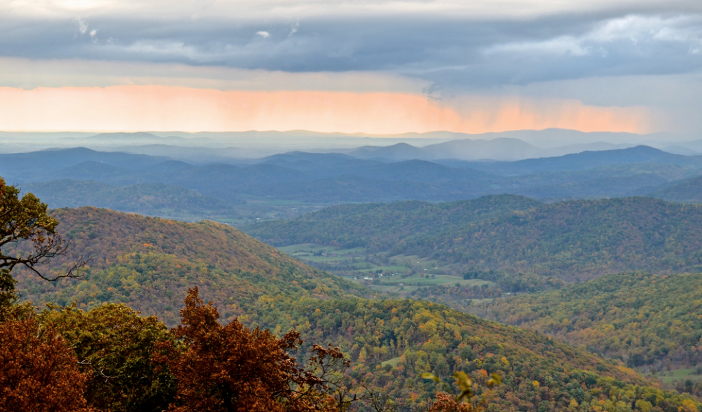
Shenandoah National Park sits only 75 miles from D.C. and is even closer to Charlottesville and Harrisonburg. As a result, two million people converge on the park every year. Shenandoah is bisected by Skyline Drive, a federal highway with 75 different overlooks. The A.T. parallels the drive, serving as a foot-traffic highway during the warmer months. As a result, Shenandoah receives a lot of car and day hike traffic. Families cruise Skyline Drive, pick an overlook, and descend in throngs on short loop hikes and easy out and backs. Skyline Drive’s overlooks may sound off-putting, but they act as magnets to the majority of the Shenandoah’s visitors, leaving the rest of the park almost untouched. There’s 80,000 acres of federally designated Wilderness sitting inside the park’s borders, boasting 175 miles of tranquil footpaths that escape the casual park visitor’s attention.
Shenandoah is split into three districts, Northern, Central, and Southern, the last of which is dominated by Wilderness and is largely overlooked by the typical park visitor.
“The Central District attracts a lot of day hikers and cars,” says Wilson Riley of the Potomac Appalachian Trail Club. “The Southern District is pretty much left alone, particularly on the western side of the ridge where there’s quite a bit of Wilderness that doesn’t have the amenities day-hikers and scenic drivers like.”
We’ve designed a three-day loop traversing the Big Run portion of the Southern District that starts and finishes at milepost 81. This hike will take you through a diverse range of terrain while delivering the solitude you desperately crave. The Big Run area of the Shenandoah is pristine and rugged. Expect trails that are rocky and often overgrown, forcing you to scramble through rock outcroppings, bushwhack to summits, and dance across pregnant streams.
From the overlook parking area at milepost 81, descend on Big Run Loop Trail from the ridgeline to Big Run Portal Trail. Big Run, a stream that blooms with rainfall and spring runoff, parallels the trail for several miles, offering several swimming holes and mandatory river crossings. Choice campsites along the banks of the stream are plentiful. Pick a site you like and bed down early or spend the rest of the day exploring the corners of Big Run.
Day Two
In the morning, finish hiking Big Run Portal north to Rocky Top Trail, which will take you back south toward your ultimate destination of Lewis Peak. Navigate large swaths of talus rock on Rocky Top while enjoying consistent views of peaks dotting the sky to the west. After 3.5 miles, take Lewis Peak Trail and look for a good campsite. Lewis Peak is a dead-end route that cuts deep into the Wilderness, offering some of the most remote camping in the entire national park. Set up camp and take the trail to its terminus where you can catch a spur that will get you close to Lewis Peak’s summit. From there, it’s an easy bushwhack and rock scramble to the top of the mountain, which is punctuated by rock outcroppings and 360-degree views. You can find slightly better views in the park, but you’d have to share them with other people.
Day Three
Backtrack down Lewis Peak Trail and hang a right on Rocky Top Trail. In just over two miles, you’ll hit the Big Run Loop trail junction. Hang a left and spend the rest of your day exploring the swimming holes of Big Run before heading back to your car. Another option is to stay straight on Big Run Loop and cross Skyline Drive to Doyle’s River Trail, which leads to the impressive Doyle’s River Falls. It’s a popular day-hiking destination, but the tiered waterfall punching through a small rock canyon is a great way to end your trip, particularly after a heavy rain when the water is rushing.
CONGAREE NATIONAL PARK
There’s a good chance you’ve never even heard of the Congaree National Park. Established in 2003, the Congaree is the newest member of the park system in the East, a fact that leads many to overlook the South Carolina gem when picking a backcountry destination.
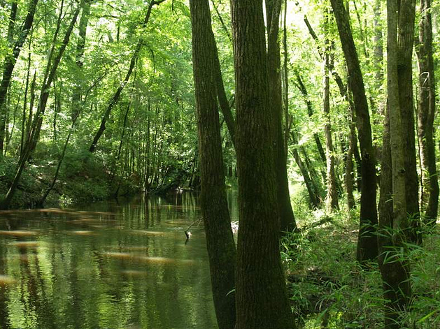
The 22,000-acre swampy park consists of the largest old-growth floodplain forest left in North America, and is often referred to as a vegetative museum. The average tree canopy height within the Congaree is 100 feet, with several loblolly pines and bald cypresses reaching state and national champion sizes. The biggest tree in the park stretches 167 feet toward the sky and 15 feet in circumference. One hundred and seventy species of birds call the Congaree home, as do 49 species of fish, 53 species of reptile, feral hogs, white-tailed deer, owls, pterodactyls—okay, there are no dinosaurs inside the park, but the ecosystem certainly feels prehistoric. Scientists are even looking for the famed ivory billed woodpecker inside the Congaree’s borders.
“Even if you just stand still on the boardwalk trail right next to the visitor center, you’ll begin to see animals moving in the woods,” says Sandy Rankin, owner of Adventure Carolinas, an outfitter that runs trips into the Congaree.
Of the 22,000 acres that make up the Congaree, 17,000 of them are designated as Wilderness. The park is lucky to attract 150,000 visitors a year. Compare that to the millions that flock to our other parks, and you have the makings of a remote three-day backpack unlike any other. The itinerary we’ve put together maximizes the park’s canoe trails while allowing you to stretch your legs in some of the more remote corners of the swamp.
Day One
The park has 20 miles of hiking trails, but most backpackers looking for an adventure choose to explore the ecosystem by canoe or kayak. The Congaree floods ten times a year, turning low-lying channels that spread from the main tributaries into water trails begging for exploration. Arrange for a boat and shuttle through Adventure Carolinas (www.adventurecarolinas.com) and start paddling the Cedar Creek Canoe Trail from Bannister Bridge. It’s a six-mile paddle from Bannister Bridge to the Cedar Creek Canoe Access take-out. Many Cedar Creek tributaries venture deep into the belly of the park, passing by giant loblollies and the “great knees” of the bald cypress trees—extensive root systems that rise above the water’s surface. Cedar Creek and its tributaries offer primo backcountry camping opportunities, (permits are free in the Congaree).
Day Two
At the canoe access takeout, pick up the King Snake Trail on the southern bank of the river and head deep into the forest. (Arrange a canoe pick up with Adventure Carolinas). Most land-locked hikers stick to the boardwalk trail next to the visitor’s center, leaving remote trails like the King Snake utterly desolate.
Hike eight to nine miles, connecting the King Snake Trail with the Oakridge Trail and River Trail in order to reach the best campsite in the park—a flat, picturesque plot along the River Trail that sits on the bank of the slow, wide Congaree River. Set up camp and try to take a dip in the Congaree before the sun sets.
Day Three
Wake early and finish hiking the River Trail loop which will eventually bring you back to the Oakridge Trail. Connect the Oakridge with the Weston Lake Loop to check out Wise Lake and Weston Lake, two large pools of flood water that attract wildlife of all sorts at various times of the day. From Weston Lake, take the Sims Trail back to the visitor’s center.
