Twelve years ago, Kentucky hiker Shad Baker had a dream: to create a long-distance hiking trail in eastern Kentucky that rivaled the classic footpaths of the Smokies. He hoped that such a trail would enable hikers to walk in the footsteps of the legendary Kentucky pioneer Daniel Boone through a wild, primitive landscape.
So Baker began talking to friends, organizing volunteers, and floating the idea to various state and federal land agencies. After years of meetings and negotiations—and then years of land acquisitions and fundraising—and then several more years of building and blazing the footpath—Baker has turned his dream into a 44-mile reality.
The Pine Mountain Trail is the longest in Kentucky, and it crosses the state’s second highest mountain. Yet few people have ever stepped foot on it. Last Friday, I decided to trek from its eastern terminus near Elkhorn City, Ky., to its western trailhead near Whitesburg.
From Elkhorn City, the footpath climbs steeply up to the Pine Mountain ridgeline, where it undulates between 2500 feet and 3500 feet for most of the journey. ATV trails criss-cross the footpath for the first few miles, and graffiti mars ancient caves and rock formations.
But at Skeet Rock Knob, the first major summit, I was rewarded with a jaw-dropping view of the eastern Kentucky mountains.
Water is scarce along the trail, so I made sure to stop at Jenny Falls, a cascade just before the Birch Knob Tower. A mile later, at Birch Knob Observation Tower, I soaked in another eastern Kentucky panorama. I thought to myself, This is what Daniel Boone must have seen…except for the beheaded mountains. Mountaintop removal sites encroach upon the Pine Mountain Trail from all sides.
From Birch Knob, the trail follows a gravel road for about a mile before it re-enters the forest near Mullins Pond and continues to roll along the ridgeline.
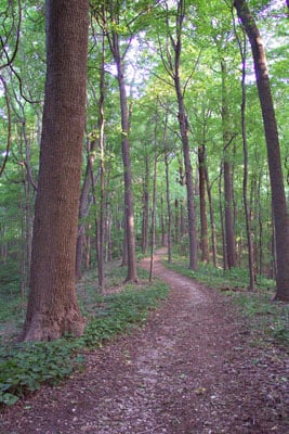
Only one other road crosses the entire stretch of the Pine Mountain Trail: four-lane U.S. 23 at Pound Gap. A gas station there provides a convenient place to restock before embarking upon the 15-mile Highland section. The first six miles of this section are pristine, well-manicured singletrack that rolls through deep, lush forests. However, after Rose Gap, the trail bed disappears, and hikers are left to bushwhack for a few miles. I followed yellow blazes from tree to tree, slashing through overgrown thickets. Baker and the Pine Mountain Trail Conference plan on re-building this section of trail with the help of a Sierra Club volunteer trail crew in October. In the meantime, the bushwhack will challenge even the most experienced hiker’s navigational skills.
Finally, the trail emerges onto a razor-thin section of exposed sandstone. The stunning vistas from the narrow ridgeline trail make the bloody-shinned bushwhack worth the effort. For the final five miles, the trail crosses several sections of exposed rock, offering views that can only be described as stunning. Amid the rolling green waves of mountains were the brown deserts of mountaintop removal sites. Not until I stood atop High Rock and looked out across the mountains—many still intact, many decapitated by mountaintop removal—did I realize eastern Kentucky was so beautiful…and so vulnerable.
Fortunately, Pine Mountain’s unqiue geology has spared it from mountaintop removal mining. Pine Mountain is an overthrust fault, which means that layers of rock from deep below the Earth were in such strong compression that one side of the layers broke and slid up and over the other, according to Roy Crawford, president of the Pine Mountain Trail Conference and one of the founders of the trail.
“If you hold your hands flat and vertical in front of you with your fingertips touching, then slide one hand up over the other, you’ll have a side view of the geology of Pine Mountain, with different fingers being shale, sandstone, and limestone,” explains Crawford.
The rocks of Pine Mountain were formed millions of years before coal was, meaning they were much lower in elevation, continues Crawford. Whatever coal may have been on top of Pine Mountain has eroded off.
Thanks to geology, time, and the sweat labor of volunteers like Crwaford and Baker, the 44-mile footpath across Pine Mountain is one of the most spectacular hiking experiences in Appalachia.


