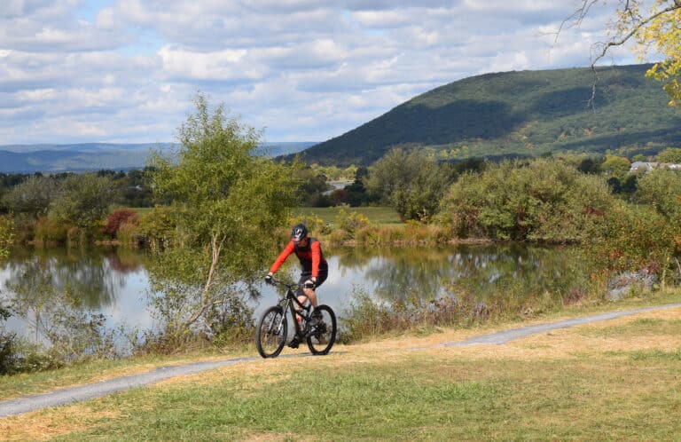
Call it land recycling at its finest or the industrial revolution in reverse-taking abandoned railroad corridors and turning them into trails. The practice actually started in the mid-1960s, but lately the development of Rail Trails is exploding. Today, there are 13,150 miles of rail-trails that see over 100 million users per year, and right now another 14,000 miles in the project phase. Developing these trails is a no brainer in the eyes of the mainstream conservation and environmental movements. It’s recycling land and conserving wildlife habitat while creating new non-automobile transportation options and as easy recreation access. The level grades and obstacle-free design make rail-trails ideal accessible destinations for running, cycling, and cross-country skiing.
New trails are developed at the hands of local initiative. People that see the potential of a railroad corridor that is not being used can get help from the Rails to Trails Conservancy, which helps local groups solicit funds from federal transportation dollars.
“Railroads ran through the center of people’s lives, connecting urban centers out to rural farmland,” says Jennifer Kaleba of the Rails to Trails Conservancy based in Washington, D.C. “The idea beyond putting out a beautiful path is to use these trails to connect more Americans across the country within a growing network that offers other transportation options.”
The Southeast has certainly been no slouch in developing rail trails. Here are some of the region’s best:
<h4>W&OD Trail:</h4> The Northern Virginia Regional Park Authority calls this 45-mile stretch from Arlington to Purcellville the “the most popular rail-trail in the U.S.” Hoards of cyclists hit this shaded path on the weekends, but locals are currently fighting a threat from Dominion Power to build power lines along the trail. Check out the issue at www.savethetrail.com.
<h4>C&O Canal Towpath:</h4> D.C. runners and bikers love this gem that starts right in Georgetown and scenically skirts through the Potomac River Valley for 184.4 miles to Cumberlan Md.
<h4>Virginia Creeper National Recreation Trail:</h4>
Damascus is the mid-point of the 34-mile Virginia Creeper Trail, a rails-to-trails cycling gem. Bikers looking for a challenge can do the steady 17-mile climb to White Top Station, or for those looking for an easier ride, an outfitter can provide transportation to White Top for a downhill ride back to town. The Creeper is also a favorite for running and horseback riding.
<h4>New River Trail State Park:</h4> This 57-mile path in Southwest Virginia mostly parallels the New as it’s crushed stone surface that is popular for biking and horseback riding connects the recreation opportunities in the Mt. Rogers National Recreational Area and Shot Tower Historical State Park.
<h4>Greenbrier River Trail: </h4>This 77-mile gravel trail follows the C&O railroad bed from the mining community of Cass to the well-known resort town of White Sulfur Springs.
<h4>Allegheny Highlands Trail:</h4> This scenic 23-mile asphalt and limestone sand trail follows Leading Creek through picturesque farmland and borders the Monongahela National Forest near Parsons.
<h4>Stone Mountain Trail:</h4> Atlanta area residents know this as a three-mile greenway through Freedom Park and Candler Park, but it’s much more. The continuous 18-mile stretch of car-free paths and on-street bike lanes connects Midtown Atlanta to Stone Mountain Park.
<h4>Silver Comet Trail:</h4> The 50-mile Silver Comet runs from Smyrna, Ga., about 13 miles northwest of Atlanta, through three counties to the Alabama state line.
<h4>Swamp Fox Passage:</h4> The South Carolina trails runs 27 miles through the swampy wetlands and coastal pine forests of Francis Marion National Forest.
<h4>Railroad Grade Road:</h4> This 10-mile path in Western North Carolina’s Ashe County is a scenic local road along the South Fork of the New River that runs from Todd to Fleetwood.


