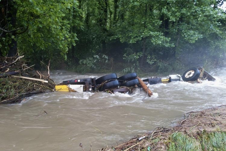
After nearly two weeks of rainfall, Maryland, Western North Carolina, and Northern Georgia are starting to see devastating flooding, with Ellicott City, Md. being hit the hardest. Be sure to follow the National Weather Service and your local news channels for the latest alerts and be safe out there!
DEVELOPING: Flash flooding, water rescues reported in Maryland as heavy rain soaks much of the state. https://t.co/CfWjWkGHWA
Video shows water rushing down Main Street in Ellicott City, just outside Baltimore. It's the same street devastated by flash flooding in July 2016. pic.twitter.com/b3DMOcVswi
— ABC News (@ABC) May 27, 2018
Ellicott City, Md. Flooding
It looks like something out of a movie. Rivers of murky, brown water flowing under a torrential downpour washing large amounts of debris through the streets of Ellicott City, a small city located 30 minutes west of Baltimore. The area experienced a similar flood in July 2016. The area has received eight to ten inches of rain in under three hours, with more rain on the way.
The cleanup effort is underway and will take a while to complete. Nearly 200 cars alone were swept away by the flooding. One death has been reported, Sgt. Eddison “Eddie” A. Hermond of the National Guard. He was washed away by floodwaters while attempting so help save a stranded woman.
MCDOWELL COUNTY UPDATE: A landslide has comprised the integrity of Lake Tahoma Dam. MANDATORY EVACUATIONS underway from the Dam at Lake Shore Dr to Lake Tahoma Rd (NC 80) to the confluence of the Catawba River near Resistoflex Rd and Riverside Park. ACT NOW TO PRESERVE YOUR LIFE!
— NWS GSP (@NWSGSP) May 30, 2018
Lake Tahoma Dam Landslide
In the early hours of May 30, the National Weather Service in Greenville-Spartanburg issued a Flash Flood Emergency for McDowell County and the areas downstream of Lake Tahoma and Lake Tahoma Dam to the North of Lake James along the Catawba River. This is a potentially catastrophic situation affecting thousands of people. A Landslide has compromised the integrity of the dam and is currently being inspected by engineers. Residents and vacationers have been issued mandatory evacuations. There area is also under a high landslide watch.
The Washington Post reported, “By 10 a.m. Wednesday, McDowell County officials announced that an engineer had inspected the dam and deemed it to be safe, and said people could return to their homes.”
INSANE VIDEO coming out of Western North Carolina. This is from the Hickory Nut Gorge Brewery. Heavy rains from #Alberto are causing major issues in the Southern Appalachians. #Breaking #Flood #FlashFlood #Flooding pic.twitter.com/ihuHjLe5EF
— WeatherNation (@WeatherNation) May 30, 2018
This is the first time that floodwaters of this level have been seen since 2004, with rainfall from the area ranging from 15″-19″ in the past two weeks. There is additional Flooding throughout Western North Carolina in Buncombe, Transylvania, Polk, and Henderson counties. In Buncombe County, the French Broad River’s flood stage is at 16′ and it is currently sitting at 18.5′ as of 9:45 a.m. this morning. In neighboring McDowell County, the Catawba River’s flood stage is 11′ and is currently sitting at 15.45′ as of 3:15 a.m. this morning.
A Flash Flood Watch remains in effect until 8pm today across far north Georgia #fox5atl #fox5storm https://t.co/UKGlp5Qyo6
— FOX 5 Atlanta (@FOX5Atlanta) May 30, 2018
Parts of Northern Georgia are under a Flash Flood Watch until 9 p.m. tonight. About 3″-6″ of rain has fallen in the area over the past 24 hours with more rain on the way.


