The intense heat is starting to break, and the first hints of refreshing breezes are reminding us fall is just around the corner. Autumn in the Mid-Atlantic and Southeast regions are uniquely stunning due to diverse landscapes and elevations, resulting in long and colorful foliage seasons.
To prepare for leaf-peeping, states across the region have begun releasing foliage prediction maps for the upcoming season, showcasing when and where the most color will likely be. Here’s a look at a handful of forecasts for peak autumn hues.
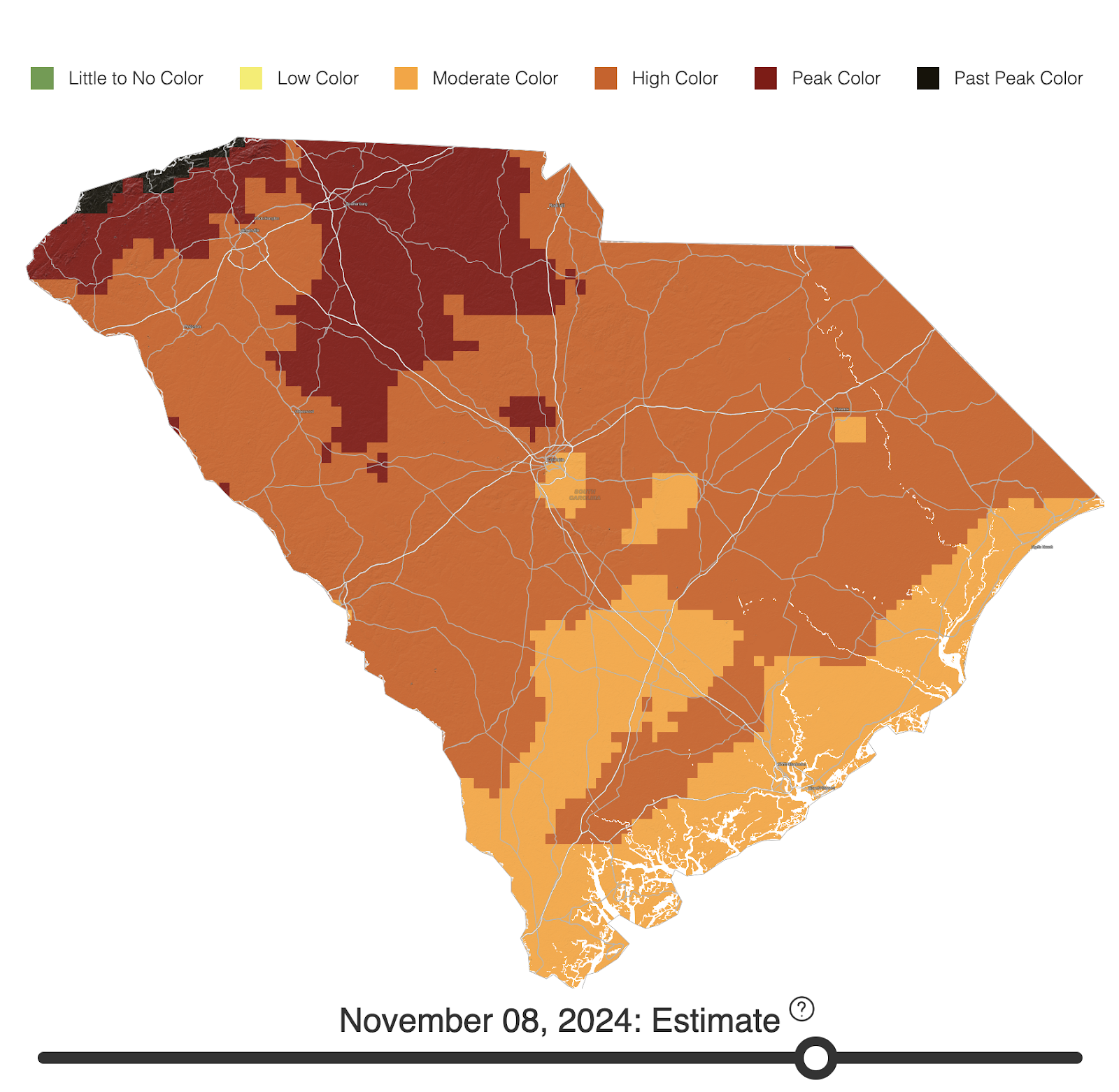
South Carolina
The best map we found for South Carolina’s leaf color comes from Explore Fall, a website that creates interactive fall foliage prediction maps for the entire United States. By sliding the toggle at the bottom of the map, viewers can see the color shift across the state from September to the end of November. According to the map, colors will start in the Upstate region and gradually work down across the entire state, peaking in early to mid-November.
Virginia
Virginia is for Lovers put together a full foliage report, complete with a downloadable map showing when each part of the state will peak throughout October, tips and hikes best for leaf peeping, and weekly foliage updates starting in late September. According to the map, leaves start to change at higher elevation areas of southwest Virginia and Roanoke and move eastward throughout the season.

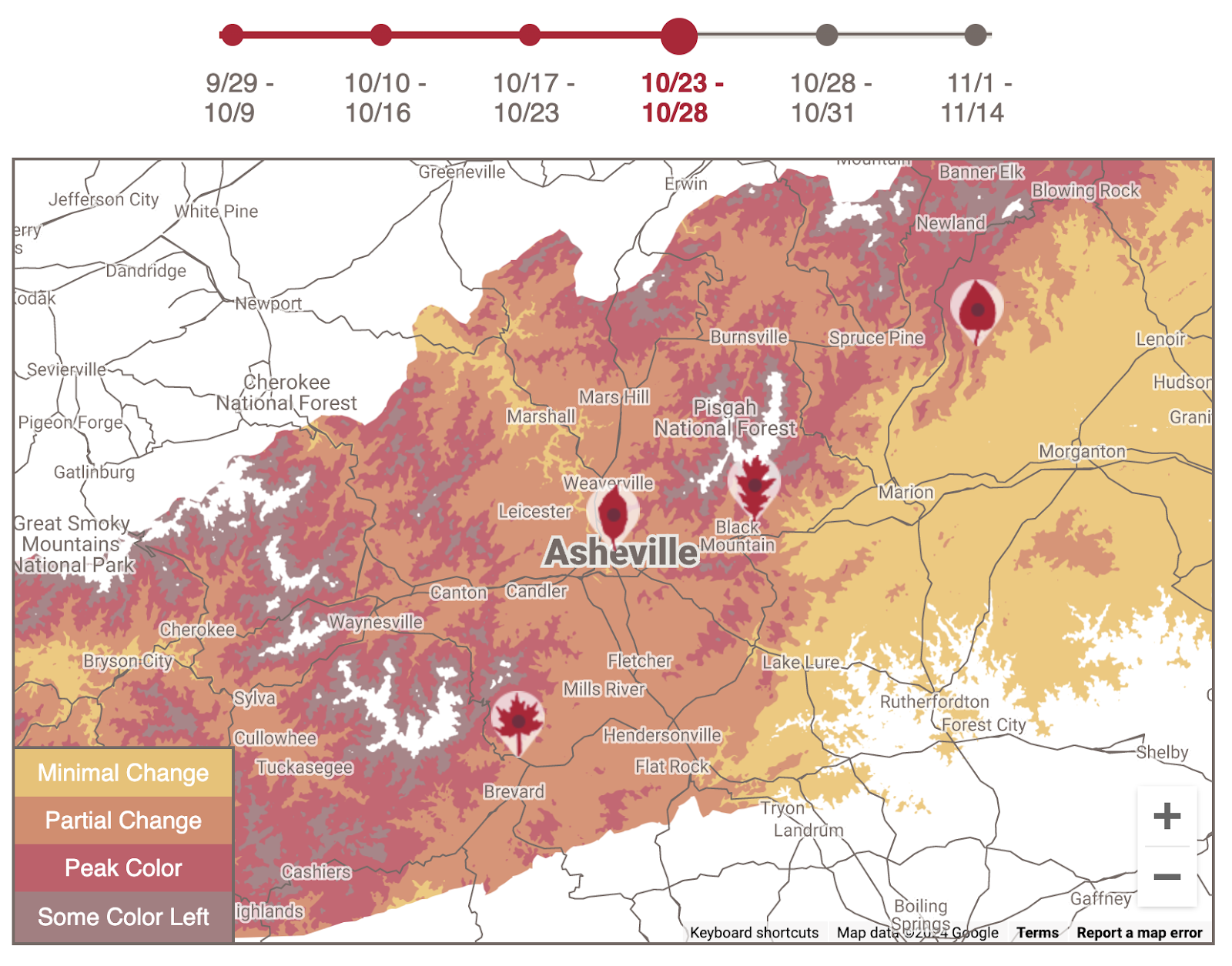
Western North Carolina
Explore Asheville’s interactive map shows the progression of fall foliage from now until mid November, in the mountains surrounding Asheville, N.C. Colors start to pop at higher elevations in mid-October before cascading downward into the valleys and foothills in the following week. According to the map, the time between 10/23-10/31 will have the most leaves left on trees and peak color.
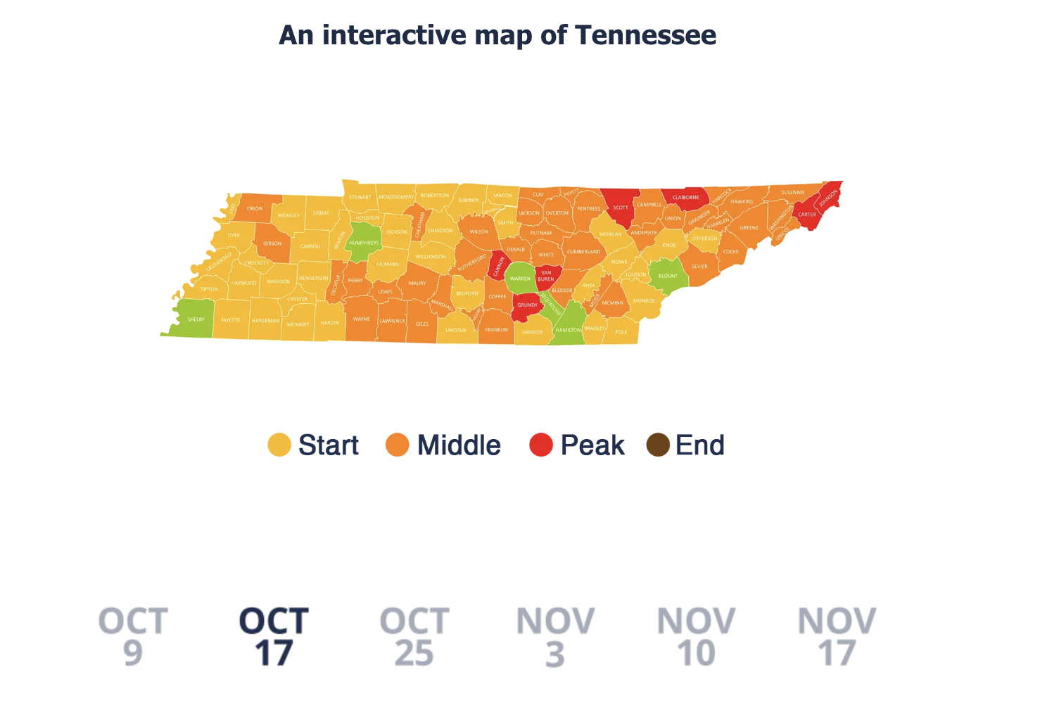
Tennessee
TheSmokies.com created an interactive map along with a list of tips for catching the best foliage across all of Tennessee. The map is similar to Asheville’s in that it shows the progression of fall foliage across the state from early October until mid-November, breaking the data down by county. According to the map, the best foliage will start to pop in the higher elevations of the Smoky Mountains in mid-October. Peak time should paint the entire state in bright colors around early November.
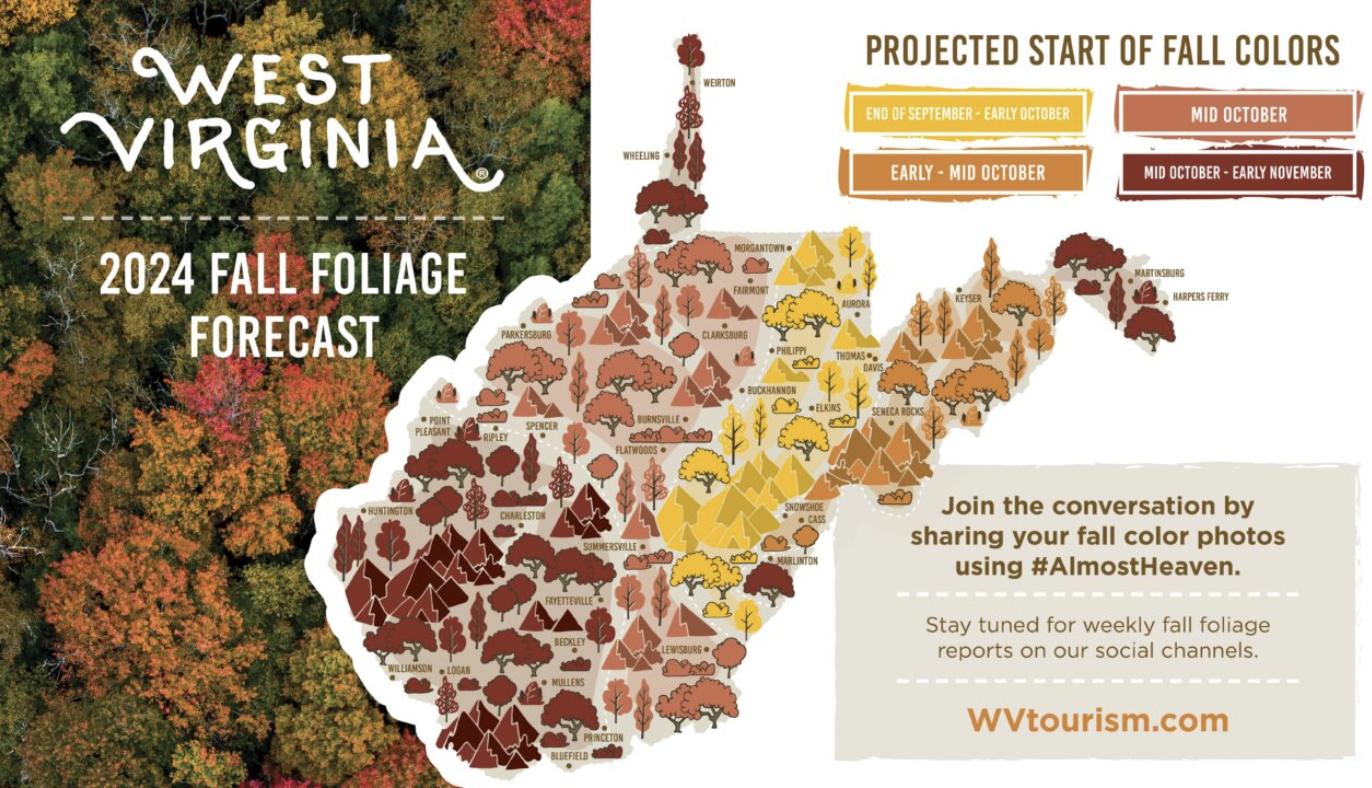
West Virginia
West Virginia Tourism’s fall foliage map shows colors starting near the center of the state from Aurora to Marlington and spreading outwards towards Fayetteville, Huntington, Martinsburg, and Weirton. As the third most forested state in the United States, West Virginia has plenty of open terrain to check out the changing leaves.