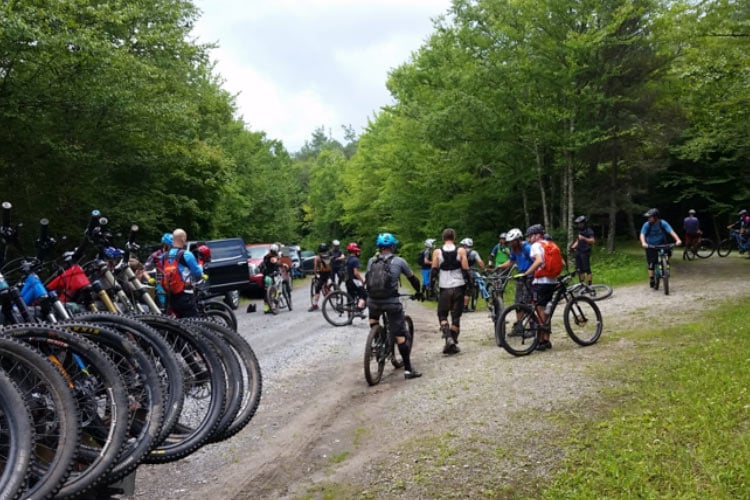
Mark your calendars and join us, Pocahontas Trails (Poca.Trails), August 11-12 for our 4th annual Slatyfork Enduro as part of the West Virginia Mountain Bike Association Enduro Series!
Established in 2013, Poca.Trails is an IMBA Chapter trail organization based in Pocahontas County, West Virginia, and our members are passionate about preserving the hand cut, technically-rugged, cross-country designed trails the region is known for. And in case you haven’t heard, Slatyfork is home to old-school, world-class, root, rock, and mud-slinging singletrack that’s sure to rattle the chamois off any experienced rider. If you’ve ridden here then I’m sure you have stories to share, but if you haven’t we’re going to tell you why you need to grab your gear and head our way, but first, a bit of local insight.
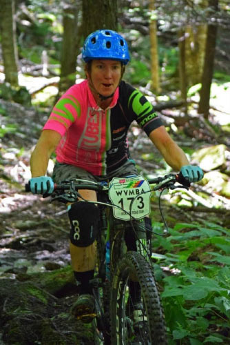 Just a few minutes drive from Slatyfork is access to miles of technical and unrefined trails within the Monongahela National Forest. Back in the “early days” when bikes were fully rigid, or offered 2-inch travel elastomer forks at best, word got out that Slatyfork was the place where gnar was created. Riders from around the country flocked to the area looking to test their skills, and during the area’s prime it became home to legendary xc-races races Fat Tire 50 Festival, Wild 100, and the iconic Gauley Headwaters IMBA Epic Ride.
Slatyfork became an ultimate mountain bike destination, but with time the style of mountain biker changed, so did the bikes and the terrain riders were seeking. By the mid-nineties, long distant grinds over roots and rocks were out, downhill flow trails were in, and the old-school ways of xc-riding became a thing of the past. With lack of interest came neglect, and endless miles of singletrack were eventually taken over by dense brush that would eat your handlebars, windfall that made trails impassible, and severe erosion that made old rail grades mud sucking booby traps.
Fortunately Poca Trails was established and came to the rescue with mattocks, shovels, and rakes in hand! Mile by mile thanks to a continuous working agreement with the Monongahela National Forest, we’ve cut, cleared, and dug out miles of forgotten trail systems. Go ahead, call us old school, but we believe the technique of sustainable, hand-cut trail design is the preferred method as the use of machinery to restore singletrack is becoming a common practice.
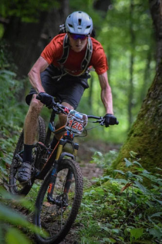 It’s not just our slice of Nature’s playground that makes Slatyfork a place you need to visit, the local community and businesses are something special too. We’re tight-knit and without communal support Poca. Trails would cease to exist and there would be no Slatyfork Enduro. We have the Pocahontas County Convention and Visitors Bureau (CVB) to thank for funding trail maintenance, and for actively promoting the sport of mountain biking in the region; Snowshoe Mountain Resort for providing us with race shuttle operations, financial support and generous prize donations; and local businesses for contributing additional funds.
The Slatyfork Enduro is more than just a gravity fed bike race, it’s about bringing together and creating a supportive trail community. The event is also Pocahontas Trails primary fundraiser to help with purchasing tools, insurance, and local area promotions. So when you make the decision to register, you’re not only making a commitment to get outdoors, have a great time, and experience a day of riding like no other, you’re also supporting our local trail efforts and community. So get registered, grab your gear and family, and encourage others to do the same!
To view the schedule of events and more details visit: Poca Trails Slatyfork Enduro; for race registration: webscorer; and for the overall series: WVMBA Enduro Series.
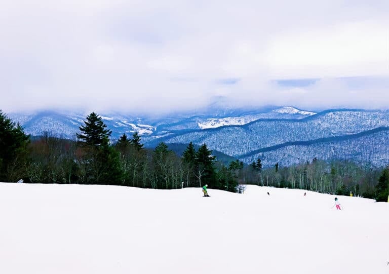
The weather can be unpredictable and temperatures are likely to be ten to fifteen degrees cooler than wherever you are. Spectators are encouraged to hike and enjoy the vistas along the race course, but please be mindful of racers on the course. While you’re in the area visit the counties other attractions including: Snowshoe Bike Park, Cass Scenic Railroad, National Radio Astronomy Observatory (NRAO,) bike or paddle the Greenbrier River Trail, trout fishing, the Scenic Highway, Cranberry Glades and more. Check Pocahontas County CVB for all the fun options.
Race Details
Race length is 22 miles, and includes two shuttles, food, music, and a great prize table and cash payout for the elite categories. Review the course profile map, then take a couple of minutes to watch the course preview. If you’re wondering, “it’s an Enduro, why two shuttles?” Without a shuttle the only other way up from the bottom of Turkey Point Connector or the Tea Creek Mountain trail is grinding up asphalt, and that seems to take the fun out of it, although a few hardy souls always choose to do the grind just because. Check out the course preview, it says 2017, but we did not change anything since it is so much fun.
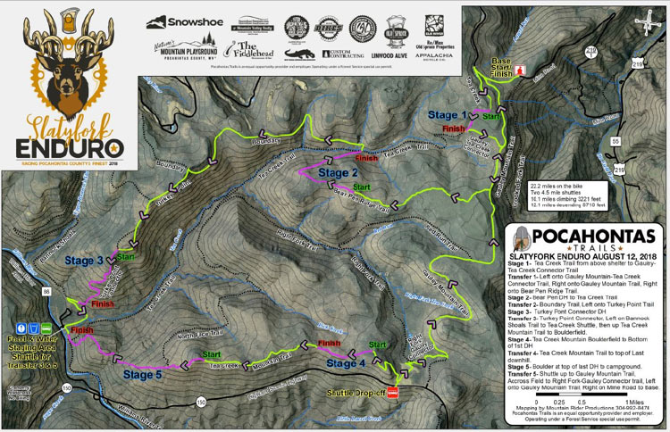
Stage 1 The race starts on Mine Road at the landing across from FR 844 (this is near the top, about a ¼ mile from Gauley Mountain Trailhead). Racers Meeting at 8:30, start at 9:00. From there a short warm up to Tea Creek Trailhead and gentle climb to the start of Stage 1. Though short, this stage is a blast, ¼ mile or so of rolling grade to the shelter and then turn it on – single track, natural berms, and root and rock stair steps to the finish. That takes you to the Gauley Connector, a slight grade (old logging railroad) with more roots, rocks, and ancient RR ties onto Gauley Mountain Trail to the climb up Bear Pen.
Stage 2 starts at the rock chair, a short climb above the shelter. This stage is a bit longer – double track, baby rock garden to single track and then open it up on a skid grade, just over a mile of fun. The climb up Boundary is next, pretty easy up to the final push up at the spruce thicket. At the intersection, you jump on Turkey Point / Saddle Loop. This is really fun, transfer rolls / flow / short downhill.
On your way to Stage 3 stop at the intersection of Boundary and Turkey Point for a short 100 ft hike to a vista of Tea Creek, Right Fork, Red Run and the surrounding mountains. The view and wilderness are breathtaking.
Stage 3 starts with a bang – rock garden, short peddle to a left hand entry to an off camber skinny rock garden, then hang on for a mix of double track / single track rock and roll descent. The stage stops short of Bannock Shoals which is the transfer to the Tea Creek Campground shuttle staging area.

Stage 4 After a quick shuttle up the Scenic Highway to the Tea Creek Mountain trailhead, there is a bit of a climb to the famous rock garden on Tea Creek Mountain – the start of Stage 4. This is the fitness stage – nail the rock garden, peddle some flow, and drop in. Pick your line and it is not butter, but pretty smooth.
Stage 5 One more climb on Tea Creek Mountain to the final stage at the big boulder at the start of the final descent. Pure single track, downhill delight. Depending on how far back in the lineup you are, you will probably smell some hot brakes about midway down. Just when the arm pump sets in, you get to the last 1/3, a bit more technical and just as steep, watch for the babyheads – they have teeth. The finish is on the Williams River Trail. Then a short peddle to the river – pick your wading line, we lost the bridge in the flood. Shuttle back to the top (last shuttle at 4:00 pm). Head through the field on Right Fork to the Connector (short, but a joy to ride) to Gauley Mountain Trail to the landing.
Thanks to our sponsors, and a huge shout to the Monongahela National Forest for the special use permit and all the hard work on the trails, Snowshoe Mountain Resort for shuttle service, the local community for support, WVMBA, and our volunteers and most of all the racers.

Pocahontas Trails is an equal opportunity provider and employer.
Pocahontas Trails is a Permit Holder of the Monongahela National Forest. Operating under a Forest Service special use permit.

